The Perkiomen Trail is truly one of the gems of the southeastern Pennsylvania region. It’s a very picturesque multi-use trail that winds through the beautiful landscape surrounding Perkiomen Creek in Montgomery County, Pennsylvania.
It’s part of the Circuit Trails, a developing 800-mile urban/suburban network of trails in greater Philadelphia.
A Bit Of History
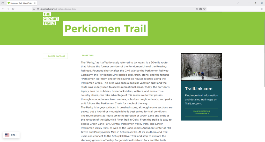
According to the Circuit Trails website, the Perkiomen Trail was built on the former Reading Railroad-Perkiomen Branch corridor that carried freight, agricultural goods, recreational traffic in the 19th and 20th centuries, as well as the famous “Perkiomen ice” from the several ice houses that used to exist along Perkiomen Creek.

The trail passes along both sides of Perkiomen Creek on its way up to Green Lane Park, a huge 3,400 acre multipurpose park with a long lake with a major reservoir that supplies drinking water for the area.
Along the way, you’ll pass through various historic towns including Collegeville, Schwenksville, Spring Mount, and Perkiomenville.
Also along the way are interesting historical features including the John James Audubon Center at Mill Grove, and Pennypacker Mills (more about them below).
Trail Details
Trail Length
The Perkiomen Trail measures at 20.6 miles point-to-point from its southern terminus that’s about half a mile beyond the Lower Perkiomen Valley Park, to the northern terminus at the edge of Green Lane Park.
Trail Surface
The treadway is a mixture of pavement and crushed limestone. I estimate that it’s roughly about a 40-60 mix. It’s paved through both the Lower Perkiomen Valley Park and Central Perkiomen Valley Park, and most of the way through Green Lane Park. You’ll also find a paved surface through the towns, on either side of road crossings, and along the “big hill” portion on Spring Mount. The trail uses road surfaces for very short distances in the northern segment of the trail, and obviously those are paved as well.
The remainder of the treadway surface is crushed limestone which is very easy to ride on. Be warned however, that there’s an approximate 1/2 mile-long portion in Green Lane Park between Snyder Road and Deep Creek Road that is much coarser gravel making for tricky riding conditions.
I’ll touch more on this below; but for now, this portion is easily avoided by simply turning right onto Snyder Road at the end of the trailhead, left onto Deep Creek Road, and then picking up the trail again on the right about a half-mile after the left turn onto Deep Creek Road.
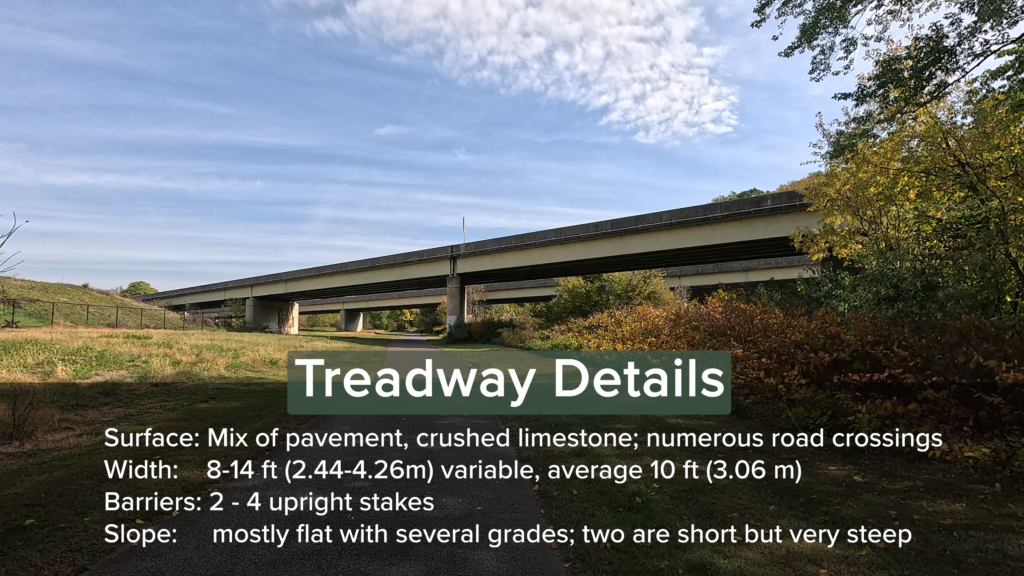
The treadway width ranges from 10 – 14 feet (3.05 – 4.27 m) with a very short portion between Crusher Road and North Ridge Road that narrows to about 6 feet (1.83 m).
The trail barriers, or “bollards” as they’re called along this trail, are mostly spaced well apart enough to traverse through them with a bicycle. I’ll note a few sets of trail barriers that you’ll want to be more cautious with below.
Trail Signage
Montgomery County uses standardized signage for their trails. The Perkiomen Trail signage is easily found at many crossing points, and looks really cool!
You’ll see a number of Perkiomen Trail signs with arrows to guide the trail user in the direction to continue on the trail, where there are multiple turning options.

This trail uses “quarter-mile” mileage markers. You’ll find them either on the right or left side of the trail. They are mounted such that the signage faces the trail instead of facing the trail user, so you’ll have to look to the side to see them. It’s not a major issue, because for the most part, they sit about 3 feet from the ground, and their poles are rather easy to spot from a distance away.
Trail Views
On the Perkiomen Trail, expect a beautiful mix of suburban towns, tree-lined rural areas, and the frequently-present views of Perkiomen Creek itself. The trail crosses the creek several times, affording excellent vistas of the creek over its bridges that range from wood decking, concrete, and asphalt.
There are a few spots – mostly on the southern segment of the trail – where the creek is far below the trail. While the vistas are breathtaking, just be aware that there aren’t a lot of guard rails along those cliff sides.
Trailheads
The Perkiomen Trail has a good number of trail access points along its 20+ miles that can be used for staging.
The largest are the three parks (Lower Perkiomen Valley Park, Central Perkiomen Valley Park, and Green Lane Park), and these can be considered true “trailheads”. These three trailheads are augmented by multiple trail access areas, that vary in size, as well as in the presence or lack of amenities.
Technically, the closest public parking for the southern end of the Perkiomen Trail isn’t at the terminus itself, but about a half-mile northward at the Lower Perkiomen Valley Park. There is a closer parking area that’s on the “western” side of Station Avenue, up a 180-degree switchback, but it’s listed as being for the Schuylkill River Trail. But there’s nothing saying that you can’t stage there, come down the switchback, and ride the Perkiomen Trail. They’re pretty laid-back about that in Montgomery County.
So, I’m going to start listing them in order, from the start of the trail by Lower Perkiomen Valley Park, northward to Green Lane Park.
Lower Perkiomen Valley Park (Trailhead)
The Lower Perkiomen Valley Park is in Oaks, PA, and sits about a half-mile from the southern terminus of the trail.

It’s a very large park, with over 200 parking spaces spread over multiple parking lots, so you shouldn’t have any difficulty finding a place to park for staging.
The park also features multiple benches and pavilions, rest rooms, water facilities, and a bicycle repair station at the upper end of the park just after mile 1 of the trail.
The park is on New Mill Road that’s accessible from Egypt Road.
Collegeville (Trail Access)

The Collegeville trail access sits between the trail and East Third Avenue. It has about 25 spaces, a bench, bike racks, and a bicycle repair station.
Though there aren’t any water or toilet conveniences at the trail access area itself, restrooms and water are easily available close by at a restaurant and a convenience store across East Main Street from the trail access.
Rahns (Trail Access)

The Rahns trail access is a relatively small lot. It’s gravel and unlined with space for about 16 vehicles.
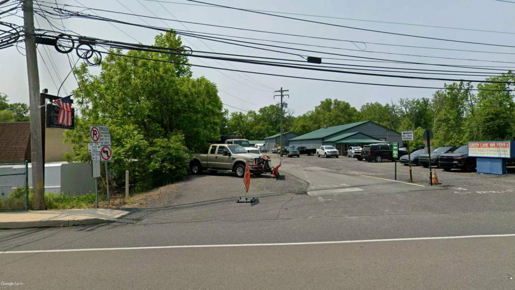
There aren’t any conveniences at the trail access area itself, but there is a small business area just beyond the trail access at the intersection of Bridge Road and Gravel Pike, that features a coffee shop, a gas station, and a pizza restaurant.
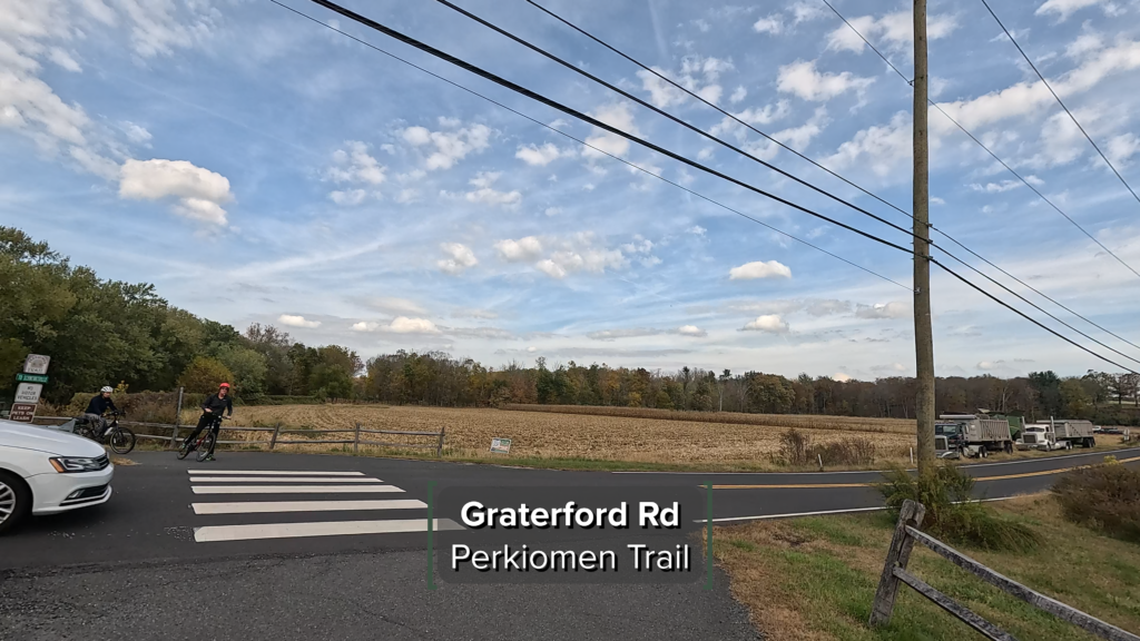
Graterford (Trail Access)
The Graterford trail access sits between the trail and Gravel Pike, just north of the local PECO terminal (PECO is the local electricity company). It’s a fairly large paved/lined parking area with space for a bit over 40 vehicles and features a bike rack at trailside.
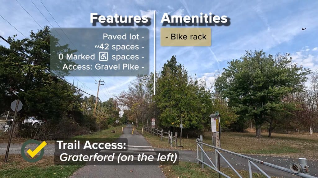
Like Rahns, this trail access has no water or toilet facilities, but there is a pizza restaurant just north of the parking area on the same side of Gravel Road, so it’s very easy to reach.
Hollywood (Trail Access)

The Hollywood trail access in Graterford is so named because it’s accessible from Hollywood Drive that itself is accessible from Perkiomen Creek Road.
It’s a small paved/lined lot for about 15 vehicles with one marked handicapped space. It has no toilet or water facilities (at last view), but there are some benches available.
This is an interesting trail access point because it’s one of the few that are in the middle of a large wooded area, and the trail cuts across the access road. So if you’re looking for a very quiet and “zen” area to stage, this one may be for you!
Central Perkiomen Valley Park (Trailhead)
This trailhead sits between Graterford and Schwenksville (its address it listed as Schwenksville), and is just past the 10-mile mark on the trail. So, it can be thought of as the “halfway mark” for the Perkiomen Trail.


The Central Perkiomen Valley Park is a decently-sized park but it appears to be split into two segments on either side of Plank Road. The trail runs along the western edge of the park itself.
The main part of the park below Plank Road has about 75 spaces spread over multiple lots, as well as rest rooms, water facilities, bike racks, and a bicycle repair station.

The other portion of the park on the north side of Plank Road has its own parking lot with 32 spaces and a pavilion.
At both portions of the park, you’ll find a sufficient number of handicapped-accessible spaces. All of the lots are paved and lined.
Schwenksville (Trail Access)
You’ll find various parking options in Schwenksville itself, but the “official” trail access lot is just north of the borough’s water and sewer department building and the trail’s crossover of the accessway into Meadow Park. It sits between the borough building and the trail.

This trail access is paved and lined, with about 29 spaces including 2 marked for handicapped access. There are multiple amenities either at the trail access point itself, in the borough hall/community center that sits on the western side of the parking area, and at Meadow Park which can be accessed either by the accessway mentioned above, or via a set of stairs near the north end of the trail access.
At the top of the stairway is a deck that features four interpretive signs, that we’ll feature in a little while.
Oh, and by the way, there are some decent “oh, I gotta stop here” options in Schwenksville too, including a bicycle shop, a cafe, and a bakery!
Cedar Road (Trail Access)
This trail access sits effectively along the top of “Spring Mountain” off of Cedar Road. It’s the only trail access point that isn’t literally next to the trail, but it does have a connector spur from the parking area to the trail, which makes this trail access point a really nice place to stage if you want to go crazy with multiple up and down attempts on the “big hill.”


Just note that there are no amenities at this trail access.
Spring Mount (Trail Access)
The Spring Mount trail access sits alongside the trail atop a small rise after you cross Spring Mount Road.

It features a Porta-Potty and benches, and you can use the railing for a bike lock point if you need to.
This is a nice stop if you like pizza or pasta, since “Johnny’s Pizza and Pasta” is right next to the trail access lot, as is “Joe’s Spring Mount Hotel.”
Crusher Road (Trail Access)
The Crusher Road trail access is the last true trail access point before Green Lane Park. It sits between Crusher Road (hence the name) and the trail.


It’s all gravel and unlined with space for about 40 vehicles, and features a Porta-Potty and benches at trailside.
It’s a nice trail access point for the northern portion of the trail without having to go into Green Lane Park itself to stage.
Green Lane Park (Trailhead)
Just like the other two major parks along the Perkiomen Trail, Green Lane Park has multiple parking lots with more than sufficient spaces in which to stage.
The lot that’s directly next to the trail is at the intersection of Deep Creek Road and Snyder Road, and features a large paved and lined lot with about 185 spaces (but only two marked handicapped spaces). There are other lots spaced throughout the park that you can use as well.


While there are no amenities at the large Deep Creek Road parking area itself, you’ll find rest rooms and water facilities elsewhere within the park.
Green Lane Borough (Trail Access… kind of…)
The official trail map from Montgomery County lists “Green Lane Borough” as the final trail access point. They place it right at Gravel Pike, where the trail stops (the northern terminus).

However, taking a look at the photos, there does not seem to be any specific parking dedicated to the trail itself. In fact, the white sign at the trail terminus says “no trail parking”… so I’m not sure if we can call the area at the trail terminus a true “trail access” point, since you can’t park to stage there.
But I suppose if you ask nicely, some of the businesses around the trail terminus may let you park in their lots.
Riding The Trail (Trail Tips)
Confusing The Obvious
The Perkiomen Trail terminates at its northern end at Gravel Pike in the town of Green Lane, and at its southern end at the intersection with the Schuylkill River Trail in the town of Oaks.
The Schuylkill River Trail, itself a fantastic trail that crosses Perkiomen Creek using the Station Avenue bridge, does a “180” off the bridge down toward the creek, abuts the southern terminus of the Perkiomen Trail, and continues under the Station Avenue bridge in a general northwesterly direction along the Schuylkill River.
I mentioned in the video that, as is sometimes the case, there’s a bit of confusion among some major trail apps about the location of the actual start of the Perkiomen Trail.
How Some Apps Mark This Trail

TrailLink, a service of the National Rails To Trails Conservancy (which Secrets Of The Trails proudly supports), places the start of the trail in a weird place – firmly on the Schuylkill River Trail on the southern side of the Station Avenue bridge, that’s clearly marked on Google Maps as the Schuylkill River Trail.
I’m not saying that the switchback isn’t a cool bit of trail to ride, but that bit of trail clearly belongs to the Schuylkill River Trail, not the Perkiomen Trail.

AllTrails doesn’t actually seem to have the southern terminus as a starting point on any of their curations for the Perkiomen Trail. This is probably just an oversight, since AllTrails does have a curation for the trail labeled as “Perkiomenville to Lower Perkiomen Valley Park”, which is the curation that I used as a guide for my ride that you can see on this post’s accompanying video.

Even Montgomery County’s own map for the trail can be a bit confusing as to the start of the trail, because they’re using two different color schemes for the Schuylkill River Trail and the Perkiomen Trail, BUT they use the same color for “the Perky” (the affectionate name for the Perkiomen Trail that’s used by locals) and the Audubon Loop Trail, which can make it confusing for the visitor as to which trail is which.
On MontCo’s map, the southern terminus of the Perkiomen Trail is obscured by the “P” parking area mark that’s beside the “A” that marks one of the Schuylkill River Trail’s parking areas (see the map closeup on the right). Looking at the map, it’s hard to tell where they’re claiming the start of the trail is, because the brochure’s map uses the same color for both the Perkiomen Trail and the Audubon Loop Trail.
However, because both trails are managed by Montgomery County, it’s safe to assume that MontCo officials know that the Perkiomen Trial starts at that red-marked “L” bend directly underneath the “P” marker on their map.
I just wish that whoever designed this map would have used a different color for the Audubon Loop Trail and drew those two different colors “side-by-side” for the portion that the two trails share.
Google Maps places the start of the trail accurately.


Regardless of which trail app you use, there’s one thing you can’t mistake: the fact that the Perkiomen Trail starts at that junction of the Schuylkill River Trail below the switchback, because it’s clearly marked as “Mile 0”.
Breaking It Down
One of the charms of the Perkiomen Trail is its location.
Because it passes through suburban towns, parks, and rural areas, and has so many access points, it’s easy to break it down into more manageable segments for people who don’t want to (or can’t) do the entire 20.6 miles of trail for a full 41.2-mile out-and-back.
When you look at a map of the entire trail, you can mentally compartmentalize the whole thing into three sections: a “southern portion” from Oaks to Collegeville, a “central portion” from Collegeville to Schwenksville, and a “northern portion” from Schwenksville to Green Lane.


Looking at the one-way “point to point” mileage, the “southern portion” and “central portion” are both approximately 6 miles each, and the “northern portion” is approximately 8 miles.
So, if you want to plan shorter rides, you can use any of these segments for an out-and-back, or any smaller portion thereof – this trail is so versatile, it’s easy to just hop on and off practically wherever you want!
The Mill Along the Creek
One of the coolest historical features is less than a half-mile from the southern terminus, albeit being on the opposite side of the creek: the John James Audubon Center at Mill Grove.
From the trail, you can look through a decent break in the trees to see a small dam of sorts and a building on the opposite side of Perkiomen Creek.
According to the Montgomery County Parks, Trails and Historic Sites Department, the area where a water treatment plant currently sits, was the site where James Morgan built a saw and grist mill around 1760, along with a mill house and other structures.


John James Audubon, the famous naturalist in whose honor the Audubon Society is named, made his home on that site from 1803 to 1806.


That whole site, including the parts that can be seen from the trail, comprises the Audubon Center. It’s a great historical site in Montgomery County, and well worth the visit. It’s not too hard to reach it by bicycle either, just by using the Audubon Loop Trail that I mentioned earlier.
It’s Not Flat
While a good majority of the Perkiomen Trail is either flat or has very mild slopes, the trail as a whole is by no means completely flat.
There are several portions of the trail that feature slopes of greater than 2%. You’ll find them along Indian Head Road, the switchback near Graterford, Spring Mount, and a few portions of Deep Creek Road in and around Green Lane Park.
None of these, with the exception of Spring Mount (more on this one below), are what I would call difficult slopes, nor are any of them very lengthy. You can think of them as a bit more than “rolling hills”.
Beside the above, there are a fair amount of very mild “rolling hills” along this trail that make it a beauty to ride.
The “Bollards”
Along this trail, you’ll notice the “Bollards Ahead” sign around each crossing point. I know that one of the definitions of the term “bollard” is “one of a series of posts preventing vehicles from entering an area”, but I’ve just always called them “trail barriers”. Using the term “bollards” on the video sort of sounded like I was saying something naughty!
Given the sheer number of crossing points on this trail (more on that below), you’ll see that a few sets of trail barriers are placed very close to a 90-degree bend in the trail. You’ll see this along:
- Indian Head Road
- the First Avenue crossover (north of Collegeville)
- the Graterford Road crossover’s southern side (the trail not only bends sharply right, but slopes uphill)
- the southern side of the East Park Avenue crossover (north of Schwenksville)
- The Green Lane Park trailhead’s southern entrance off of Deep Creek Road


I’d recommend going slowly up to and through these barriers – I wouldn’t recommend trying to go through any of them “at speed.”
Sharing The Trail
I mentioned earlier that MontCo’s trail map indicates that the Audubon Loop Trail shares a bit of the Perkiomen Trail from the latter trail’s southern terminus near the end of the Lower Perkiomen Valley Park.

At this “T” in the trail, the Perkiomen Trail continues to the right, while the Audubon Loop Trail continues to the left. The Audubon Loop Trail then follows New Mill Road to Egypt Road, turning right across the creek, and looping down on the other side of the creek toward the Audubon Center. After leaving the Audubon Center, the Audubon Loop Trail runs parallel to Pawlings Road, picks up a small portion of the Schuylkill River Trail across the Station Avenue bridge, and turns left at the bottom of the switchback to share with the Perkiomen Trail through Lower Perkiomen Valley Park.
So, if you want to check out the lower part of “the Perky” and also visit the Audubon Center, you can rather easily and safely do it all by bicycle.
Watch For Falling Rocks?
There are a few portions of this trail that, well… let’s just say I hope you’re not severely claustrophobic or afraid of heights.
Since the trail follows the railbed for the former Reading Railroad-Perkiomen Branch, it’s no surprise that you’ll encounter small portions of the trail that have a sheer drop-off towards the creek on either side of the trail. Be careful in these areas, because not all of them have guard rails or fences to stop a wayward trail user from tumbling off into the creek!


You’ll also notice certain small portions along the trail that have a steep rock face on one side or both.


Certainly during these times (which thankfully aren’t very often), you want to be careful while riding; look and listen for falling rocks. If you do see or hear something, just make sure you’re ready to either stop suddenly, or to pedal really, really fast to get out of the way!
The Many Crossings of the Perkiomen Trail
Notwithstanding the fact that the Perkiomen Trail is a very easy trail to ride, there’s one thing that you’ll notice rather quickly.
This trail has a lot – and I mean a lot – of road crossings. There are only a few that could be considered “busy”, while a number of the others cross tertiary roads or what can be considered little more than driveways, so I wouldn’t expect that you’ll encounter any significant traffic on those.
So, in the interest of completeness, I have included pictures of all of the road crossings that I have encountered below, all taken from the video, so if you haven’t watched it yet, check it out after you finish reading (as always, just click on any image to enlarge it).


Of all of the road crossings noted above, I’d like to bring your attention to the following. I’m basing “right” and “left” as being the right and left hands of the cyclist or hiker, and on the assumption that you’re traveling on the trail from south to north, following the mile markers from 0 through 20.
Cider Mill Road
The intersection with Cider Mill Road can be problematic because on your left, Cider Mill Road goes uphill and bends to the right – so traffic coming down the hill either may not be able to see you and/or may not want to stop.


Below the crossover is the intersection of Cider Mill Road and Arcola Road. Though it looks like a 3-way intersection, Cider Mill Road ends there, and Arcola Road turns left and crosses the creek.
Oh, and by the way, it’s called Cider Mill Road because at that intersection, there was an old cider mill. Check out the video made by one of my YouTube friends, “LumberjackPa“, where he shows the remnants of the old cider mill. LumberjackPa is a hiker, and has some other great videos on his channel!


Arcola Road

The crossover at Arcola Road is similarly touchy, because on the left, Arcola Road bears slightly uphill and curves left, creating a sort of blind hill.
Fortunately, there’s enough space to “creep out” and make your presence known, but there are no crosswalk lights here, so I wouldn’t expect motorists to stop just because they see you on the side of the crossing.
Second Avenue
In Collegeville, the Second Avenue crossover is at a four-way intersection with a traffic light. So, crossing with the pedestrian signal is safe; it’s following the trail on the other side of Second Avenue that requires explanation.
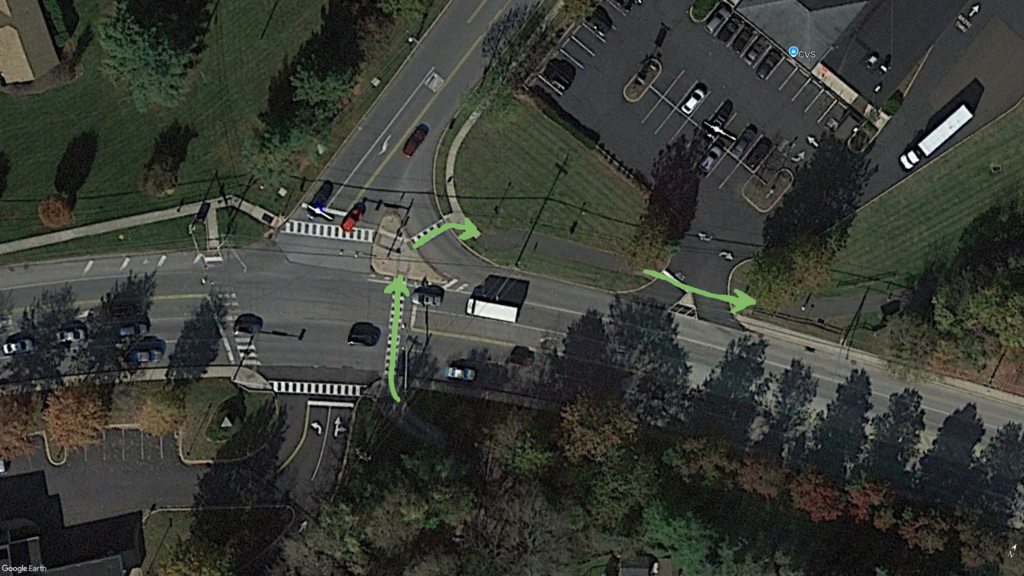
On the other side of the crossover, there’s a safety island between Second Avenue and a turning lane for Park Avenue. The trail runs over the safety island, crosses the Park Avenue turning lane, and passes in front of the parking lot for the CVS Pharmacy that’s on that corner. It’s too easy to mistakenly go straight onto Park Avenue if you don’t watch where you’re going.
East Main Street
Also in Collegeville, the crossover with East Main Street (as pictured above) is busy – there’s a four-way intersection with a traffic light at this point, but it’s easy to cross with the light/pedestrian signal.
First Avenue
Between Collegeville and Graterford, the trail crosses First Avenue (PA 29). This one wouldn’t seem difficult to cross, since there’s a pedestrian/trail signal light at the crossover point, and the visibility is fine since it’s a long stretch of flat, straight road. The problem comes in when motorists want to ignore the signal lights and fly right through the crossover.


I actually experienced this first-hand while I was filming for the video.
If you watch the video, you can see a motorist flying through the intersection while the lights were flashing and I was standing there waiting to cross. So, what the motorist did is technically illegal, since Pennsylvania law requires motorists to stop for pedestrians and cyclists at crossovers/crosswalks. It’s too bad that there wasn’t a state trooper on the road behind that guy.
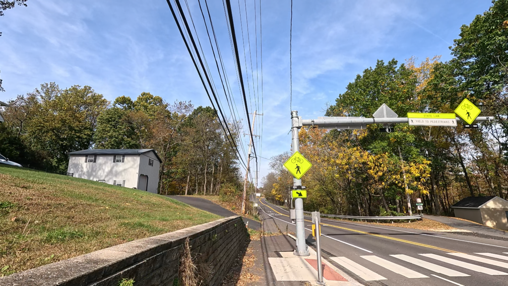
Spring Mount Road
The last potentially problematic crossover is at Spring Mount, where Spring Mount Road bears left and uphill at the crossover, with Main Street intersecting opposite.

The road to the left of the trail user (again assuming a south to north travel) is a limited sight distance zone, so people coming down the hill may not see you. Also, the trail on the opposite side of Spring Mount Road is a near instant 4-5% upslope (I’m estimating, so anyone who’s interested, please feel free to measure it and correct me), but it’s not advised to cycle through this crossover to catch the hill – there’s even a “CYCLIST DISMOUNT” sign at the crossover.
No Lack Of Interpretive Signs

The Perkiomen Trail doesn’t have quite as many interpretive signs as I’ve seen on some other trails, but it doesn’t mean there there aren’t any at all along the trailsides.
Along the way, you’ll encounter small interpretive signs highlighting various natural features, including bird life and fish that can be found in the creek.
You’ll also see a few in Collegeville, including one about Camp Shalom, as well as one about the Collegeville area itself, and four at the Schwenksville trail access point featuring different aspects of Schwenksville’s history. There are a few others – so ride the trail and keep an eye out for them!


Stop for a moment at these signs, and read up on the history – it’s fascinating!
The Switchback
Right around Graterford is a really cool feature on this trail.
There’s a nice wood-plank surface bridge that marks the first of several times that the trail crosses Perkiomen Creek. The views from this bridge are really peaceful.


On the other side of the bridge, there is a large switchback that takes the trail elevation down to run parallel to the creek’s eastern bank. The curve around the switchback is so large, that I joked in the video that I could probably land a small helicopter on it!


Well, OK… maybe not. But it is really cool to swing around that switchback!
Round The Houses
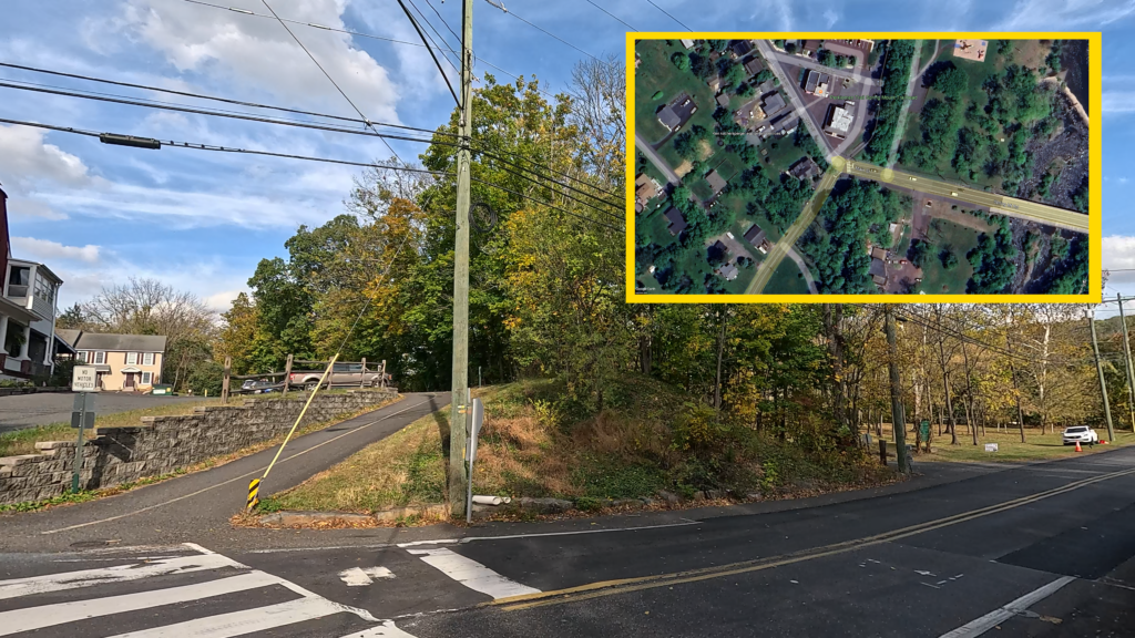
Not too far past the Plank Road crossover near Schwenksville, the trail passes around the front of a couple of houses. I wouldn’t mention this otherwise, but I make note of it here for two reasons.
First, the trail uses the sidewalk along Gravel Pike and the houses to the right, but the caution here is that the sidewalk angles downward on its right side for the driveways of the houses.


Second, the trail itself at this point is very well marked… everywhere except on Google Maps. If you look at the inset on the picture on the right (above), you’ll see where Google has the trail tracking behind the houses at this point (I highlighted it in yellow), but MontCo’s map, other trail maps, and even the ground-level signage all indicate that the trail doesn’t go behind the houses, it goes in front of them, as I marked on the inset with a red line.
Schwenksville: The Little Town That Could
Schwenksville is the demarcation line between the end of the “central segment” of the Perkiomen Trail and the beginning of the “northern segment.” It’s a nice little town along the creek, and I call it the “little town that could”, because of the history that made – and makes – this town so special.
Ice harvesting was big here, and one of the icehouses for the famous “Perkiomen Ice” was located at creekside. The rail line had a station at Schwenksville, where the community center and trail access area sits today (see the interpretive signs above).


On the other side of the creek, you’ll find the historic Pennypacker Mills, once the home of Samuel Pennypacker, a gentleman farmer who also served as Pennsylvania governor from 1903-1907. The Colonial revival mansion has been beautifully preserved, and is open to the public, offering tours and various events throughout the year.

Today, there are a number of businesses near the trail that are friendly to trail users, including a couple of restaurants. And Schwenksville has its own bike shop – Perkiomen Bicycles – that’s literally at trailside, so if you need repairs or just want to shop while you’re on the trail, they’re right there!
The day that I was filming for the video on this trail, some volunteers and a gentleman from the Montgomery County Planning Commission were conducting a survey of trail users. I stopped, responded to their survey, and had a nice chat with them about some of the ideas they had for increasing opportunities in Schwenksville to help not only the town, but those who use the trail.
So, it’s clear that Schwenksville isn’t just holding on to its past. It’s also looking toward a prosperous future.
The “Big Hill”
Spring Mount is a unique part of this whole area, though calling it a “mountain” may be stretching it a bit… it’s definitely a very big hill. It has its own ski area (Spring Mountain Adventures) along the northern slope of the mountain, and the Perkiomen Trail traverses up the southern side of the mountain for what I estimate is a 7-8% grade, and then back down its western side near the creek.
It’s this western side downslope that’s just so very unique for this trail.

It’s a verified 12% grade that starts at mile 12.75 of the trail, and continues downhill for 1/4 mile. Going down is fun (though you’ll still want to take it slowly), but going back up is usually a different matter.
I’ve heard a number of comments – and seen personally – that some people had to stop pedaling and dismount about halfway (sometimes further up) and walk the remainder of the hill. When I filmed this trail, I got about 95% of the way up (which surprised me!) until my “legs gave out” and I had to dismount.


On YouTube and Facebook, I encouraged people to tell me their success stories of making it up the hill on a bicycle at one go without stopping. I’ll point out one gentleman who’s older than I am, who said that he made it up the whole way without stopping or dismounting.
So, that just tells me is that I’ve got a challenge there… and I’ll have to go back and conquer this mountain!
Selfie Rock?
Along the northern segment of the trail between Spring Mount and Perkiomenville, you’ll find a few interesting things, beyond the beautifully-peaceful surroundings, of course.
Shortly after crossing the creek again, thus placing the trail on the creek’s eastern bank, you’ll pass an outcropping of barren rock. I’ve seen some people in the past stop and take selfies by the large rock face. I don’t know if it has any particular name, but I’ve labeled it “Selfie Rock.”


Not too far from “Selfie Rock”, you may be able to spy a large open field on the right side of the trail. That’s the area for the Philadelphia Folk Festival that’s held every August.

Continuing on northward, there’s an interesting sign on the side of the trail that caught my eye.
I’m not sure if it was saying that “hey everyone, this is a nice, quiet, residential area” or if it was some kind of warning: “hey, BE QUIET, this is a residential area!”
Regardless, I’m assuming that they don’t want people passing through with big “boom boxes” attached to their bikes blasting heavy metal music!
Rebuilding A Bridge
Sitting between Gravel Pike and Deep Creek Road near the trail’s entrance to Green Lane Park, is the Perkiomenville Bridge, and marks the last time the trail crosses Perkiomen Creek.


This bridge once carried Gravel Pike over the creek, and featured a toll house on the Gravel Pike side. After it was closed in the late 1960’s, it was rehabilitated and eventually made part of the Perkiomen Trail. In 2002, Montgomery County received a $5.8 million grant to completely renovate the bridge.
It looks fantastic and the ride is very smooth!
Look Behind You
The trail’s southern entrance to Green Lane Park is on the left side of Deep Creek Road. The trail uses Deep Creek Road for about a 1/4 mile from the end of the Perkiomenville Bridge downhill to the park’s entrance.
There is a crosswalk painted on the road surface at this point, but there are no crosswalk lights, so you should look behind you before you cross the road. Obviously, you can easily see if a vehicle is coming from in front of you.
Watch Out For Wildlife
There are several interesting things about Green Lane Park.

The more you trek through the park on the trail, you’ll quickly get the sense of just how vast it is. Look at it from above on a map, and you really see how sprawling it is.
Sitting in the middle of it all are two lakes, Deep Creek Lake and Knight Lake, as well as the huge Green Lane Reservoir that supplies drinking water for the area.
There are also a good number of walking and mountain-biking trails in this park, and two of them – the Blue and Orange Trails – intersect with the Perkiomen Trail.
And there’s one other interesting point that may be a rare occurrence, but I was fortunate enough to just be in the right place at the right time during filming for the watch out for wildlife!


If you watch the accompanying video, you can see where I’m going slowly around a bend in the trail, when I encounter a deer a short distance ahead of me, grazing on the grass! The deer stood there for a few seconds as I stopped to enjoy this natural spectacle, but then it turned and darted off into the brush.
That was definitely a “GoPro Awards” moment if I ever saw one!
So, the advice is, always look out for wildlife on the Perkiomen Trail, or pretty much any other rural trail that you’re on. If you’re lucky enough to see some wildlife on the trails, snap a picture if you can!
Bad Gravel
As I mentioned above, there’s an approximately half-mile-long part of the trail between Snyder Road and Deep Creek Road that has a good amount of very coarse gravel.


While filming the trail, I experienced a little bit of a tire slip here, though I was able to quickly stabilize my bike and had no problem. My concern here is that this portion is a hill, and in my opinion, it’s too easy to slide if you’re pedaling briskly to make the uphill run, or when braking on the downhill.
I definitely would encourage the trail managers to replace the surface with either much finer crushed limestone or (even better) pavement, to minimize the injury risk to trail users.
An Inauspicious Ending?
The trail continues around the western edge of Deep Creek Lake using Green Lane Road for a very short distance before returning to its own treadway, and terminates at an intersection with Main Street in borough of Green Lane. From all I’ve seen, that’s the end of the measured portion of the trail.
This abrupt terminus with no real dedicated parking/staging area for the trail seems like an inauspicious ending for such a fantastic trail.
However, about 3/10 of a mile after the 20 mile mark, there’s another trail that intersects with the main trail and heads left, winding through the trees and past the local middle school, then terminates at one of the upper parking areas for the park along the reservoir. Looking at the MontCo map (see earlier), they have this labeled as “Green Lane Extension.”
I’ll admit that I haven’t filmed that portion (yet!), so I don’t know first-hand if it has mile markers like the main Perkiomen Trail, or what the treadway surface is like – but from overhead views, it appears to be paved.
But since this trail is just so cool to ride, I’m definitely going to ride it again – so perhaps I’ll make a “quickie” video just featuring that mile-long Green Lane Extension!
Trail Impression
The Perkiomen Trail is a beautifully fantastic ride through a lot of scenery and history. It runs through nice small towns along the creek where you can stop, take a break and enjoy the sights and sounds, as well as few challenges (if you’re so inclined, and if your legs will stand for it!) along the way. For people who want a longer ride, the whole out-and-back trail experience is over 40 miles, but it’s just as cool to do any shorter portion of this trail that you want!
I’ll stand by my impression that the Perkiomen Trail is truly one of the multi-use trail gems of southeastern Pennsylvania, and one that I think deserves to be on every cyclist’s “bucket list!”