The Great Allegheny Passage starts in Cumberland, Maryland and runs approximately 150 miles through fantastic scenic hills and valleys, to Pittsburgh, Pennsylvania.
In this post, we’re going to explore the trail segment from West Newton to Boston, PA.
History of the Trail
For a more detailed history of the Great Allegheny Passage, please see our overview.
History Along The Way
West Newton
Situated in the southwestern portion of Westmoreland County, the borough of West Newton, Pennsylvania, traces its history back to the late 1700s when it was founded by early settlers including Issac Robb who officially laid out the town.
Centered around an old Native American footpath that colonists named Glades Trail (sometimes referred to as Glades Path), the river was crossed by using Simeral’s Ferry, and this became a focal point of what eventually coalesced into West Newton. It’s said that early settlers crossed the Youghiogheny using the ferry service on their way westward, and ultimately founded the town of Marietta, Ohio.
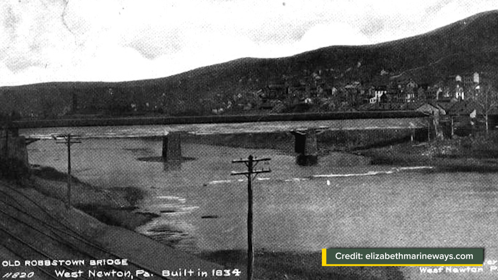
The area was originally named Robbstown and served as a trading outpost along the Youghiogheny River. The name was later changed to West Newton, believed to be an homage to Issac Robb’s hometown of Newtown, New Jersey.
The mid-19th and early 20th centuries were good to West Newton. River commerce increased with the construction of slack water dams in the 1830s. The arrival of the Pittsburgh & Lake Erie Railroad as well as the Pittsburgh & Connellsville Railroad (later the B&O), the Markle Paper Mill, and later the U.S. Radiator Corporation, made important industrial contributions to the town.

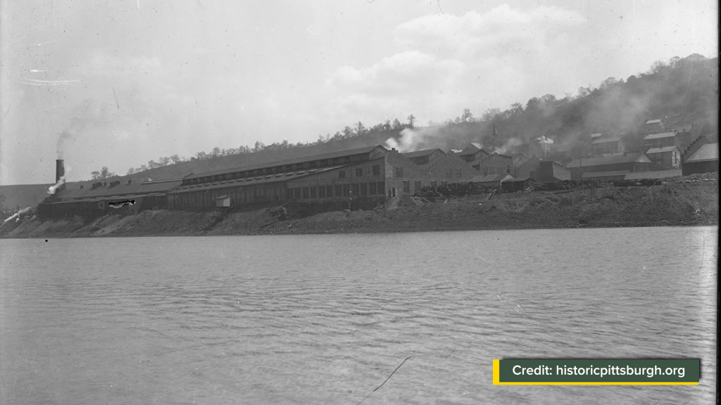
West Newton also served as an important commercial corridor for the surrounding farming communities and sprouting coal patch towns. West Newton’s population and influence grew thanks to the prosperity brought by the coal and rail industries.
However, like many towns in the region, West Newton faced challenges as the industrial boom began to wane in the mid-20th century. The decline of coal mining and the de-emphasis on rail transport impacted the local economy. The town’s growth slowed, and it transitioned from an industrial hub to a quieter residential community.


Despite these hardships, West Newton retained its historical character and adapted by leveraging its natural assets.


The Youghiogheny River became central to recreation and tourism. In the late 20th century, West Newton found renewed life as a major Trail Town for the Great Allegheny Passage. The trail brought outdoor enthusiasts, hikers, and cyclists through West Newton, revitalizing its economy with an influx of visitors drawn to the town’s scenic location and historic charm.

Today, West Newton is celebrated for its small-town atmosphere, historic architecture, and its role as a gateway to outdoor activities. The town’s journey from a frontier settlement to an industrial player, and now as an essential stop on one of the most beloved trails in the region, tells the story of West Newton as a living and vibrant bridge between past and present.
Trail Details
Trail Length
This segment measures 14.1 miles point to point, from the West Newton trailhead at GAP mile 114.1 to the Boston trailhead at GAP mile 128.2.
There are three trail access points within this segment: Sutersville (GAP mile 117.9), Buena Vista (GAP mile 120.9), and Greenock (GAP mile 126.0). These three mid-trail access points can be used as staging areas for walkers/hikers who want a shorter segment.
Trail Surface
The treadway surface is primarily crushed limestone, with an average width of 8-10 feet. There are a number of road crossings which obviously are paved, as are some of the trail leads to these road crossings particularly on what is called the “Boston Trail” portion of the segment. The trail barriers are the familiar three vertical stakes, mostly made of wood.


Along the Boston Trail portion, you’ll notice vehicle-width gates along one side of the trail berm that have location information on them. I’ll discuss more about them below.
Trail Signage
The Great Allegheny Passage utilizes standardized signage, as I mentioned more specifically in my overview of the trail [here].
Trail Views
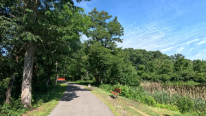
This is the last portion of the Great Allegheny Passage where we parallel the Youghiogheny River for the entirety of the segment. As with previous segments, we’re treated to some good views of the river, along with views of old coal patch towns that we ride through, a couple of really interesting waterfalls, and some other geologic formations.
We’ll also cross over a number of streams along the way, including Pollock Run, Gillespie Run, Jennings Run, Boyds Run, Wildcat Run, and Duncan Hollow Run.
Trailheads
West Newton (GAP Mile 114.1)
West Newton is right up there among the quintessential trail towns of the Great Allegheny Passage, with its multiple bed-and-breakfasts, restaurants, a full-service bike shop, a full-service biker’s campground, bakery, and even a craft brewery and a distillery.
The West Newton trailhead itself is split between two trailhead segments, separated by West Main Street (PA Route 136). I like to describe them as the “south lot” and the “north lot.”
South Lot
The south lot is, unsurprisingly, on the south side of West Main Street, which is how it’s accessed.
It’s a fully paved and lined parking area with space for over 35 vehicles in a back-to-back configuration with three of them handicapped accessible. There’s also a really cool piece of artwork at this lot facing West State Street, called the Pioneer Point statue.


The West Newton Bicycle Shop is also located here, with the Trailside Inn (a fantastic bar and eatery) occupying the upper level of the building. It’s a full-service bike shop that I’ve used in the past, and I highly recommend them if you need anything while you’re on the trail in this area.
Crossing The Street
Obviously, to cross from the south lot to the north lot and continue the trail on towards Pittsburgh, you will need to cross West State Street.

But be careful here, because traffic coming off of the bridge has limited sight distance. Fortunately, as a major trail town for the GAP, many of the locals will be respectful and stop for cyclists and hikers in the crosswalk but not everyone does.
North Lot / West Newton Visitor Center
The parking area on the north side of West State Street is split between two smaller lots that sit on either side of the West Newton Visitor Center. The lot on the south side of the building has 10 spaces with two marked for handicapped access, and the lot on the north side of the building has 20 spaces with two marked for handicapped access.


These lots, as well as the West Newton Visitor Center, are accessible from Collinsburg Road.

The West Newton Visitor Center is a perfect place to stop if you’re going through West Newton on a longer bike or hike. Consider it part of the overall trailhead, as it features a covered seating area, a bicycle repair station, bike racks, and an outside water fountain, as well as full restrooms inside the building. Note that the water fountain is usually turned off during the late fall and winter months.
The West Newton Visitor Center is a modern replica of the Pittsburgh & Lake Erie Railroad’s 1910 train station. There’s a gift shop that’s stocked with books, maps, and GAP merchandise. Adorning the walls of the gift shop are trail and footpath signs and medallions from all over the country, many of them brought in by veteran trailblazer Edward C. Tallone.


Sitting just outside the building is a combination coach/baggage car built in 1914 and used by the P&LE. It was restored in 2004.


The Visitor Center is open on specific hours all week, during the season.
The building is also the headquarters of the Regional Trail Corporation, a nonprofit organization that manages sections of the GAP in Allegheny, Westmoreland, and Fayette Counties.
Sutersville (GAP Mile 117.9)
The Sutersville trail access is a fully paved single file parking lot tucked between the Youghiogheny River and the trail, and is accessible from First Street in Sutersville.

There are 36 spaces in this lot, but there are no spaces marked as handicapped. There’s a bicycle repair station and a bench at this trail access, but there are no other amenities at the trail access itself.
However, a short walk or ride from the trail access point, there is a small café and an ice cream shop, and a gas station/convenience store on the opposite side of First Street from these businesses.
Buena Vista (GAP Mile 120.9)
The Buena Vista trail access is also used as a boat launch for the Youghiogheny River.
The main lot is paved and lined, with space for 15 vehicles though none of them are marked for handicapped access. The boat launch area can be used as a kind of overflow parking, and I’ve seen trail users parking down there.

At the far end of the parking area is a covered pavilion. While there are no toilet facilities technically at the parking area itself, there are toilet facilities, bike racks, another covered seating area, and a water fountain that can be said to be for this trail access point, because they are only about 200 yards or so just north of the trail access itself.


Interestingly, this is also the site of the Slackwater Navigation Company’s Lock and Dam #2. Read more about this below.
Greenock (GAP Mile 126.0)
The Greenock trail access point is a small lot that also serves the adjacent Twele Field, the community baseball field for Greenock.
This is another fully paved and lined lot, with 20 spaces including two of them that appear to be handicapped spaces although they are not specifically marked with the universal handicap symbol, but they are marked with separation lines. Take a look at the accompanying video for this segment, and you can see what I mean.


Across the trail from this access point, is the Twele Road Rest Stop, that features two benches, a covered pavilion, and a bicycle repair station.
This trail access is reachable via Moray Lane, which itself is accessible from East Smithfield Street through Greenock.
Riding the Trail: Trail Tips
Lots of Road Crossings
One thing you’ll quickly notice about this segment of the Great Allegheny Passage is the number of road and driveway crossings along the segment of the trail.
In my opinion, there are only two that you would want to consider dismounting and walking across, namely West State Street in West Newton, and First Street in Sutersville. All of the other road crossings are either driveways or through the old coal-patch towns that we’ll see along the way, and these roads frankly don’t see a heavy amount of traffic.
The Ol’ YRT and the Boston Trail
Youghiogheny River Trail

You probably would have seen these blue and white signs from roughly around Layton up to West Newton, and you’ll continue to see some of them all the way up through McKeesport.
Prior to the Great Allegheny Passage being “the GAP”, the section of the trail roughly from Connellsville through Boston was known as the Youghiogheny River Trail. It was (and still is) managed by the Regional Trail Corporation, with RTC chapters, including the Yough River Trail Council and the Mon-Yough Trail Council, providing maintenance.


When all of the conglomerate trails from Cumberland through to Pittsburgh were conjoined, the Great Allegheny Passage was born, incorporating all of the segments, including the YRT and the the Boston Trail. However, on some trail apps, most notably AllTrails, you’ll still see some of their active curations listed as “Youghiogheny River Trail.”
Boston Trail

Speaking of the Boston Trail, the section of the Great Allegheny Passage from Sutersville to Boston is also called the “Boston Trail”. Maintained by the Mon-Yough Trail Council, portions of the Boston Trail are little bit wider than a typical GAP Trail segment, sometimes up to 12 feet wide.
There’s a good reason for this. The Boston Trail, particularly the upper portion from Buena Vista to Boston, is typically very heavily trafficked not only by cyclists, but by trail walkers, joggers/runners, and people walking their pets. So it makes sense that some of these portions may be a little bit wider than others.
The Tragedy At German Street
No, this isn’t a slur against Germans.
You’ll notice a sign on the left of the trail (if you’re traveling from West Newton towards Boston) right at the trail’s intersection with German Street in Collinsburg.

This marker was placed by the Rostraver Township Historical Society. It commemorates an accident that took place at this intersection on September 17, 1952 when the school bus collided with a train, killing four and injuring many others.
The Last of the Coal Patch Towns
This segment passes through what I would consider the last of the coal patch towns that we’ll see along the Great Allegheny Passage on our way up to Pittsburgh.
While West Newton probably wouldn’t be considered a “coal patch” town, the communities of Collinsburg, Smithdale, Blythedale, Industry, Buena Vista, and Greenock would certainly qualify in one sense or another for this moniker.


Most of these small towns have their own playground/park and ball field, that are usually right beside the trail. The only exception to this is Buena Vista… they have a community pool with a playground.
“Great Allegheny Passage Picnic Area”?
Along the way, you’ll notice Smithdale’s community park and playground. Google Maps seems to make a particular point of labeling this as “Great Allegheny Passage picnic area.” But this appears to be the community’s park area, and not necessarily tied to the Regional Trail Corporation (RTC officials may feel free to dispute my assumption). Nonetheless, it is a publicly accessible area, and thus users of the trail should have no problem stopping there and resting if they need to.


Please watch the accompanying video on this segment, because I inserted some video that I filmed in April 2024, that shows Smithdale’s park under a bit of water. In fact, during that time period, the Yough experienced flooding, and many of the lower-lying areas along the river were impacted. Fortunately, it doesn’t appear as if the trail itself was damaged.
The Big W
No doubt you have seen concrete, wood, or steel markers with a big “W” on them in your travels either along the Great Allegheny Passage or any of a number of other rail-trails across the country.

We see a number of them in this segment, since we’re passing through various small communities that have a lot of roads that crossed the former tracks, now the trail.
According to American-Rails.com, these are known as “whistle posts.” They marked the point at which a train engineer was supposed to start sounding the train’s whistle or air horn.
Who’s Douglass?
In this context, Douglass isn’t a who, but a what and where.
The small patch of land on the western side of the Youghiogheny across from Sutersville, was known as Douglass.


If you’re following along the Great Allegheny Passage from Cumberland toward Pittsburgh, the area of Douglass will be the last coke operation that you’ll encounter along the trail.
The H.C. Frick Company once had coke ovens in this area. They were said to be in the flat wooded area between the river and the trail just after crossing over First Street. But, unlike the coke oven remnants that can clearly be seen from the trail outside of Connellsville, I don’t think that anything is left of the old coke ovens of Douglass. I may be wrong… local trailblazers can let me know if anything remains of the old Douglass coke ovens.
The Joys of Acid Mine Drainage (AMD)
Okay, so there’s no actual “joy” of acid mine drainage itself. While it is a practically inevitable outcome of the necessary coal mining from the last century, acid mine drainage (AMD) is damaging to the environment.
But if there’s any “joyful” part of acid mine drainage, it’s that we get to see some interesting sites along this segment that are directly caused by AMD.
Gillespie Run
Gillespie Run crosses under the trail on the north side of First Street, just beyond the Sutersville trail access. Its AMD comes from the Pittsburgh Coal Company’s Warden Mine which was a mile or so on the hill about parallel with and west of the Sutersville trail access. If you look closely, you can see reddish-orange staining of the AMD on the stream bed, and unfortunately this all gets released into the Youghiogheny River.


The Red Waterfall
Just outside of Blythdale, around GAP mile 118, sits the “Red Waterfall.” This is acid mine drainage from Pittsburgh Coal Company’s Ocean #2 Mine. It gets its name from the acidic iron-rich water that flows off of the hillside. At most times of the year, you can also smell the waterfall before you actually see it. This is because of sulfuric acid produced by the process of exposing pyrite to oxygen and the groundwater.


The White Waterfall
Between Buena Vista and the Dravo rest area, just before GAP mile 122, you’ll find the “White Waterfall.”


While this usually doesn’t have quite as much water flowing through it as the Red Waterfall, it is nonetheless an impressive sight to behold. The white deposits on the rocks aren’t calcium, though. They’re aluminum hydroxide acid mine drainage from the Pittsburgh Coal Company’s Painters Mine that was up on the hill beyond the trail.
Okay, So Which Name Is It?
Just before reaching the town of Industry, you’ll cross a bridge that has some interesting signs on it.

Regardless of whether you call it Industry, Frank, or Scott Haven, they all refer to the same place in this context.
Actually, there’s a town named Scott Haven which is directly across the river that’s along the B&O Railroad. But the story goes that on this side of the river, the P&LE apparently decided to name its station in this spot as “Scott Haven” too.
The name of the small town is technically “Industry”.
In his fantastic book the Great Allegheny Passage Companion, author Frank Metzger tells the story of how Industry was also named Frank. Apparently, there are two towns named Industry in Pennsylvania. The other, larger one is an old steel town in Beaver County along the Ohio River, close to the Pennsylvania-Ohio border. It got the “official” name.
So, when a Post Office was established in the Allegheny County borough of “Industry”, the Postal Service couldn’t let two Post Offices be named the same. The story, according to Metzger, is that the local postmaster was harassed by the Service until he came up with another name… and since his first name was Frank, he named the local post office “Frank.” Metzger has a photo in the book, of an old postmark bearing the name “Frank.”
Alas, these days (according to USPS.gov), there is no actual post office building in Industry (or Frank, or Scott Haven – whichever name you want to call this little town). The closest actual post office building is “next-door” in Buena Vista. Both Industry and Buena Vista are today served by the same ZIP code.
Speaking of Industry
Users along the Great Allegheny Passage traveling through the town of Industry (or Frank or… OK, I won’t keep beating this!), should be very aware of what I call “trail-clogging” when the Industry Ballfield is being used for games.
Unlike some other locations, the Industry Ballfield is literally immediately beside the trail. Because of this, I’ve often seen spectators and sometimes ballplayers standing full breadth along the trail and even putting their folding chairs on the trail itself to watch a game in progress, despite the fact that there are bleachers built just off of the trail itself.
Now I don’t think that the spectators are deliberately clogging the treadway just to be mean or that they have no sense of regard for people who want to use the trail for its intended purpose.

But if you look at the accompanying video for this segment, I included some April 2024 footage that shows that from the trailside to the field itself there is somewhat of an drop-off that makes sitting on the hillside somewhat difficult.
I say all this to make people aware that if you are riding or walking the trail through Industry when a ball game is in progress, please go very slowly and give people time to move out of your way.
Yes, TV Towers Are Still Around
As you ride from Industry through Buena Vista toward Boston, you’ll notice a very tall red and white transmission tower in the distance.

According to ChannelMaster.com, this is the transmission tower operated by local Pittsburgh television station WTAE.
A Really Good Idea
As you ride or walk along the Boston Trail portion of the GAP, you’ll begin to notice signs attached to vehicle-width gates along the side of trail barriers.

They have location information on each of them that can be provided to emergency responders if you’re either stuck or have some kind of emergency while you’re using this portion of the trail.
I think that this is a very smart idea, and I wouldn’t doubt that if eventually, we see similar signs all of the way along the GAP.
The Property Formerly Known As A Greenhouse
After leaving the Buena Vista trail access, you’ll pass by the water fountain, rest facilities, bike rack, and another covered pavilion that can be used as the amenities for the Buena Vista trail access since they’re in a very short walking distance from the trail access itself.

Just after this however, is a small parking lot on the right side of the trail, a locked vehicle-width gate on the left, and at the location of the GAP Mile 121 marker, is a fenced area – the origins of which seemed to be a mystery.
I had an opportunity to speak with Mark, the president of the Regional Trail Corporation, who informed me that this whole area on the right side of the trail including the rest facilities, pavilion, parking area, and fenced portion, was leased until 2019 by an organization in Pittsburgh called “Milestones” that works with challenged adults.


They used to have a greenhouse in the fenced area, and some gardens along the grassy area by the trail.
But the Milestones administration reached out to the RTC to try to cancel the lease because they were unable to continue using the property. One thing led to another, and Milestones, the RTC, the Mon-Yough Trail Council, as well as other interested parties struck a deal whereas the lease would be set aside, and various entities would take possession of the various portions of the area property.
The MYTC provides maintenance for the rest facilities and other amenities, and while, according to Mark, they don’t “own” the former greenhouse property, they do have “shipping container” type steel boxes on-site (and at other locations along the Boston Trail) where they can securely store maintenance equipment.
A Good Idea Gone Wrong
As I mentioned earlier in the descriptions of the trail access points, Buena Vista was the location of the Slackwater Navigation Company’s Lock & Dam #2. Their Lock & Dam #1 reportedly was roughly parallel with GAP mile 127; however no evidence of this structure remains.

If you look on Google Maps/Google Earth at the Buena Vista trail access location, you can see a thin straight island on the other side of the river from the boat launch. This is all that remains of the lock wall for Lock & Dam #2.
The concept of slack water navigation along the relatively shallow Youghiogheny River may have seemed like an workable one initially. Steamboats carried passengers, mines shipped their coal in barges pushed by steamboats up to the confluence of the Youghiogheny and the Monongahela Rivers, and thus onto Pittsburgh and points west.

However, by all accounts the whole concept was doomed to failure.
Not only was it extremely expensive to maintain the cheaply-built dams and locks, there was insufficient toll-paying traffic leading to financial difficulties. Even the river refused to cooperate, because floods and ice jams on such a shallow river regularly damaged the dams and locks, and repair funds were scarce.
Mother Nature finally put an end to Youghiogheny River’s Slackwater Navigation Company in 1867 when a severe flood and ice jam destroyed the locks and dams. This one was the final straw, and they were never rebuilt.
Sky Ferries
In the Whitsett to West Newton post and accompanying video, we encountered the Jacobs Creek Sky Ferry. Along this segment, we encounter markers noting the location of two of more: Renners Sky Ferry that connected Smithdale with Sutersville (reportedly the last remaining sky ferry that operated until the mid-1960’s); and the Stringtown/Malisee Sky Ferry right at GAP Mile 122 that connected Stringtown/Dravo and Shaner.
The Greenock Sky Ferry connected Greenock and Alpsville, but there are currently no markers for this sky ferry, but it appears that it may have been placed shortly before GAP mile 125, roughly parallel with the Youghiogheny Country Club.
But exactly what was a sky ferry?


Sky ferries were exactly what they sound like. They were little ferry cars that held anywhere from 2 to 4 people on average, and were attached to steel cables that ran from one side of the river to the other.
Miners used sky ferries if they lived on the opposite side of the river from where their mine was. It’s also said that when railroads were the principal form of transportation, residents of the small towns sometimes “played the schedules” and used sky ferries to get to one side of the river or the other to catch either the B&O passenger service on the eastern side of the Yough, or the P&LE service on the western side. It should be noted that both of these railroads even in their industrial heyday, had some passenger service.

The Mon-Yough Trail Council’s newsletter, The Milepost, is archived in PDF format on their website. Check out the December 2015 edition – there’s an article all about sky ferries that you don’t want to miss!
Preserving the Meadow
Shortly after passing the Stringtown-Malisee Sky Ferry marker at GAP mile 122, you’ll encounter a large open field it’s known as the Stringtown Meadow. Bill Metzger has a fantastic write-up of the history behind the preservation of this natural area, and I highly encourage you to pick up a copy of his book and read it. You will definitely be able to get more information than I can provide about the background and the current efforts in maintaining this incredible natural area.
The Community That Never Caught On
Just after the meadow, we will come to arguably one of the largest rest areas along the entire Great Allegheny Passage that isn’t an actual town.

The area is known as Dravo. According to some historical records, Dravo was a modest community tied to the region’s coal mining industry and river trade. However it never really grew up to become a major town and over time, its population dwindled so much that it was abandoned. Today, very little evidence remains of the original settlement.
One thing that does remain is the Dravo Cemetery, a small graveyard back dating back to 1812 and was once accompanied by the two-story wood-framed Dravo Methodist Church that was constructed around the same time.


According to GapTrail.org, the church burned twice, likely ignited by sparks from passing trains along the Pittsburgh & Lake Erie Railroad, and the property was eventually abandoned in 1920.
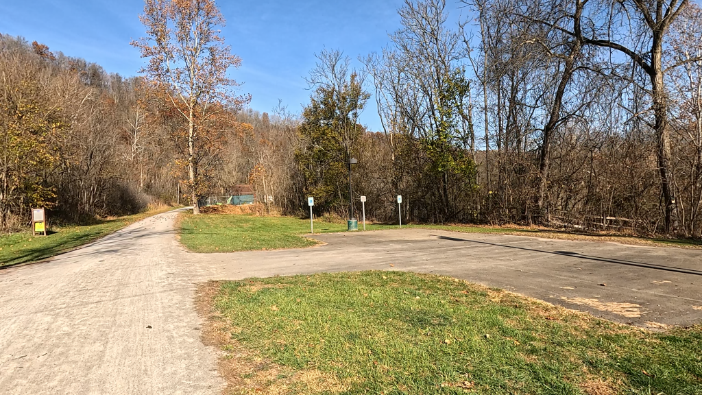
Today, this area houses large campsite facilities, known by several names: the Dravo Hiker-Biker Campground, the Queen Aliquippa Campground, and the Apache Springs Campsite.
Across the trail and blocked by a closed gate is a gravel path that eventually links up to Henderson Road in Elizabeth Township. It appears to be an accessway for campground service vehicles.
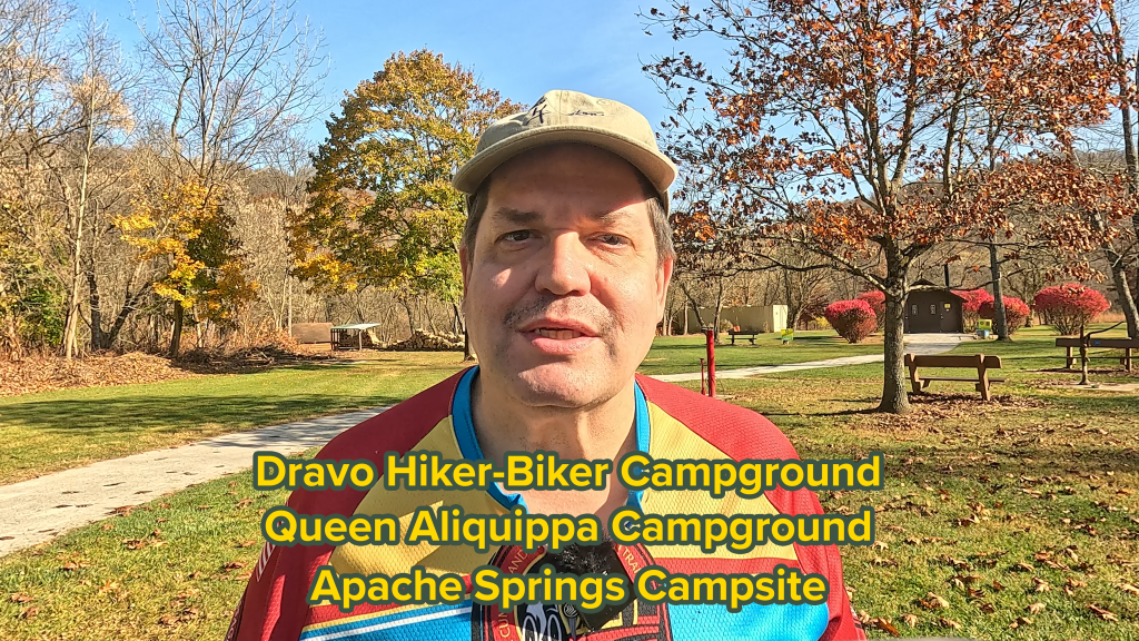

The Dravo rest stop includes permanent restrooms, and old-style but active potable water pump, bike racks, bicycle repair station, and multiple seating areas including a covered pavilion. All of this makes it a major rest stop along the Great Allegheny Passage.
Duncan Station
The last major stream crossing that we’ll encounter along this segment is around GAP mile 124. Duncan Hollow Run is a nice place to stop and relax and check out the water flowing through it (when there is water flowing through it).

When the P&LE had passenger service, this spot had a railroad shelter known as “Duncan Station” that served the mines in the area. Duncan Station was known as a “flag stop”, meaning that the train wouldn’t stop at the station unless the station’s flag was deployed.
Over The River and Through The Woods
Around this area, we’ll encounter three interesting pieces of trivia.
Across the river, is the town of Coulter. It’s most notable for being the birthplace of legendary Pittsburgh Steelers owner, the late great Art Rooney.


Also around this area, are “Slip” signs that you can see tacked to trees. According to the Elizabeth Township office, these “slip” signs were intended for contractors doing sewer work for the township in the area of the trail. They marked “slippage” areas, that is, areas of prior landslide and rock falls, that the contractors needed to be aware of as they did their work.
Finally in this area, through the woods on the left and on top of the hill, is the Youghiogheny Country Club. Unfortunately, we can’t see any of it from the trail. Fortunately, I’ve never seen any wayward golf balls sailing through the air down onto the trail. It’s my hope that none of their club members or guests have so massive a swing (and so errant an aim) that they’d brain a trail user with a golf ball.
Trail Impression
The West Newton to Boston segment of the Great Allegheny Passage is a very easy 14.1 mile point-to-point ride, with nearly flat terrain, multiple access points, quaint town scenery, as well as historical views and some geologic wonders to behold. Because of it’s nearly level terrain, it’s very widely used by locals for walking, running, as well as cycling. It’s one of those very interesting and peaceful rides along the Great Allegheny Passage!


Thank you for your description of this ride! The history is fascinating.