The Great Allegheny passage starts in Cumberland, Maryland and runs approximately 150 miles through fantastic scenic hills and valleys, to Pittsburgh, Pennsylvania.
Starting with the Deal, PA trailhead, the remainder of the Great Allegheny Passage is situated in Pennsylvania. In this post, we’re going to explore the trail segment from Deal to Meyersdale.
History of the Trail
For a more detailed history of the Great Allegheny Passage, please see our overview.
History Along The Way
Deal
Deal is a small, unincorporated community situated on the top of the Allegheny Mountains near Mount Davis in the state of Pennsylvania. While not much is widely documented about Deal specifically, its proximity to farmlands and to two major rail lines (the old Western Maryland Railway now the Great Allegheny Passage rail-trail) and the current major rail line used by Amtrak and CSX (at least according to a publicly-available PennDOT map), it’s not unreasonable to assume that, like many small towns in Pennsylvania, Deal likely has a history tied to early European settlement, coal mining, and agriculture. There does appear to be an Amish and/or Mennonite presence in the area. It’s covered by the Meyersdale School District.

There are technically two access roads into the community, Deal Road and Old Deal Road.
For those wishing to access the Deal trailhead on the Great Allegheny Passage, it sits beside Deal Road. Deal Road’s terminal intersections are Glade City Road (on the west) and McKenzie Hollow Road (on the east).
I will highly encourage any residents of the area of Deal, Pennsylvania, to offer any additional information and insight you may have regarding the history and current status of your community. I always like to make sure that we have as much information as possible about the trailhead communities that I cover here.
Trail Details
Trail Length
Starting at the Deal trailhead parking area, this segment to Meyersdale 7.3 miles to the restored train station which serves as both the Meyersdale trailhead and the home of the Meyersdale Area Historical Society.
Trail Surface
The treadway surface is primarily crushed limestone. There are a couple of road crossing points along the way. Also, there are a few wood-surface bridges where the trail crosses over streams, and the Keystone Viaduct is a cement surface.
The average treadway width in this segment is 8-10 feet.
Trail Signage
The Great Allegheny Passage utilizes standardized signage, as I mentioned more specifically in my overview of the trail [here].

Along this segment, you’ll see that the two inter-segment access points only have horizontal nameplates, but not full GAP signage.
Trail Views
The views in this segment that await you are mostly calming (who needs yoga?). Farmlands, Amish homesteads, relaxing straightaways, rolling streams, and two very cool major bridges. Don’t miss the opportunity to stop anywhere along the Keystone Viaduct for some cool shots of Flaugherty Creek, Glade City Road, and the active rail line that you’ll ride well over. You may be able to get a video of a train passing below!
Oh, and don’t forget to get a view of the historic Bollman Bridge (see below).
Trailheads
Deal (GAP Mile 24.6)
The Deal trailhead is listed on GAPtrail.org as a “rural trailhead”. To the credit of the community, you can’t get much more rural along the GAP than Deal – the rolling farmlands, on the western, windward side of Savage Mountain, views of some wind turbines, and a conspicuous lack of cell service.
The trailhead features a toilet, bicycle repair station and lock mounts, and a covered seating area. There are no water facilities at this trailhead.

The parking area is a large gravel lot with space for about 36 vehicles arranged in two back-to-back parking zones marked with curb stones. Though the GAPtrail.org site notes that there’s space for “about 20 vehicles”, there are at least 36 curb stones in the lot.
Access to this trailhead is via Deal Road (GPS address is listed as 1765 Deal Road, Meyersdale, PA 15552). Deal Road connects on the west to Glade City Road out of Meyersdale proper, and on the east to McKenzie Hollow Road, that itself is accessible from the south (Interstate 68 in Maryland) of Frenzel Road. Interestingly, McKenzie Hollow Road crosses over the Eastern Continental Divide that we discussed in the last post.
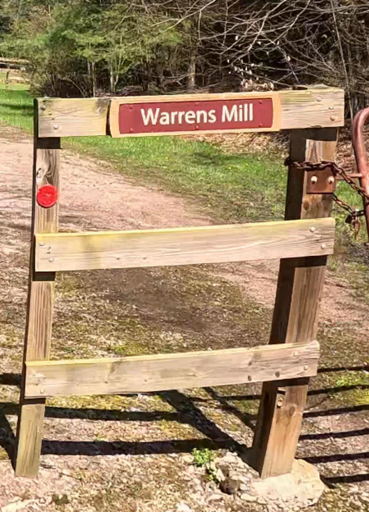
Warrens Mill Road (Meyersdale, PA) (GAP Mile 26.4, segment mile 1.8)
I’m going to include this here for two reasons, the second of which I’ll mention later.
While “Warrens Mill” isn’t an officially recognized trail access point by the GAP Conservancy (there’s no mention of it on GAPtrail.org or in their official publication “TrailGuide”), it’s marked as a GAP Trail access and as “Somerset County Recreation & Trails Association” on Google Maps.

The access straddles Warrens Mill Road, with no real parking on the eastern side of Warrens Mill Road, and a gravel lot on the western side that looks like it will hold about 3-4 vehicles, and it sits very close to the second reason I’ll mention this access: a little roadside stand labeled on Google Maps as “Amish Donuts, Jams, & Produce.” More on them later.
There are no amenities at this trail access.
Sand Patch (Meyersdale, PA) (GAP Mile 28.1, segment mile 3.5)
This trail access sits along Miller Run Road, accessible from Deal Road. It’s a gravel, unmarked lot with space for approximately 5-7 vehicles. There are no amenities at this trail access.

Meyersdale (GAP Mile 31.9, segment mile 7.3)

At GAP mile 31.9, the Meyersdale trailhead is situated at a restored train station that also serves as the Meyersdale Area Historical Society. It features full restrooms, a snack and gift shop, plenty of covered and open-air seating, a lot of bike lock racks and stands, a repair station, and large lot – paved close to the station, and a connected gravel lot – with space for well over 40 vehicles with some handicapped designated spots
Riding the Trail: Trail Tips
The Long Straightaway

The first mile and a half of this segment is essentially a very long straightaway, with only very mild curves. Deal Road runs to the north, but you can barely tell because of the vegetation along the trail. Flaugherty Creek and its wetlands run alongside the trail to its south.
For those inclined to take nice relaxing rides or walks, this segment can lure you into a nice relaxing state… it always does for me, anyway!
Warrens Mill
I mentioned above that at the trail intersection with Warrens Mill Road, there’s a small parking area, designated on Google Maps, even if it’s not officially identified as a trail access by the Great Allegheny Passage Conservancy.
Here’s the other reason I promised earlier. The “Amish Donuts, Jams, & Produce” shop sits beside the trail along Warrens Mill Road. According to Google, it’s open Monday through Saturday from 8 am to 5 pm, and features baked goods on Fridays and Saturdays.

OK, so you’re saying… “so what?” But come on… it’s AMISH DONUTS! If you’ve never tried them, you’re missing out.
Sand Patch


Sand Patch is notable not only as an inter-segment trail access, but also because of its train yards that sit to the north of the trail. The yard is active, and I’ve seen a few trains running along this segment in the past.
Keystone Viaduct
This is one of those “wow look at that” spots on the Great Allegheny Passage.
At GAP mile 29.8, the Keystone Viaduct is a massive 910-foot long, elegantly curved combination truss bridge/deck plate girder viaduct. It sails nearly 100 feet above Flaugherty Creek, Glade City Road, and the active CSX rail line we discussed earlier.


The viaduct was built in 1911 by the Western Maryland Railway as part of its expansion to Connellsville PA. Its primary span is straight, and the GAP trail curves through it, matching the bridge’s curved arc. It was modernized in 2003, including modern decking infusing iron oxide into the concrete to match the bridge’s truss girders, and two of the bridge’s original piers were removed while adding a girder. In 2011, CSX Corporation raised the entire bridge slightly to accommodate double-stacked cars on its tracks below.
It’s easily accessible from both the Sand Patch trail access and the Meyersdale trailhead.
Bollman Bridge
Very shortly after crossing over the Keystone Viaduct, at GAP mile 30.3, you’ll encounter one of the “last intact iron bridges.”
The Bollman Bridge is an 81-foot cast- and wrought-iron truss bridge, that stands as one of the few remaining bridges built by pioneering bridge builder Wendall Bollman, whose patented designs were marked by ornate cast iron end pieces, lacework, and compression members. His iron bridges contained a numbering system cast into pieces that made it easy for unskilled laborers to erect.
Interestingly, this bridge wasn’t built for the Western Maryland Railway. It was built in 1871 to carry the Baltimore & Ohio Railroad over a small body of water.
While both GAPTrail.org and GAPHistory.org cites the body of water as “Wills Creek”, the Great Allegheny Passage Conservancy’s TrailGuide cites it as “Gladdens Run.”


According to Google Maps, Gladdens Run is a tributary of Wills Creek, and there is noted to be a rail line that crosses over Gladdens Run.
OK, I suppose it doesn’t really matter where the bridge was originally positioned. It’s more important what happened to it.
In 1910, it was moved to carry a family farm road over the B&O tracks west of Meyersdale. After it was slated for demolition some years ago, it was rescued from destruction.
It seems that once upon a time along Scratch Hill Road just east of Meyersdale itself, the old Western Maryland Railway used a culvert type span, locally called “the arch”, to cross over Scratch Hill Road. But the Pennsylvania Public Utility Commission (PUC) ordered the removal of “the Arch” for the same reason they condemned the Bollman Bridge which was still sitting on the local family farm though it was no longer being used by the family.
When the Great Allegheny Passage was being designed and built on the old railroad right-of-way, this created a dangerous dilemma because the trail had to go down a grade, cross over the street, and go back up a rather steep grade to get back to the trail grade.
Well, one thing led to another, and after the tireless efforts of many (read all about it here), led to the 2006 final move of the bridge to it present location on the Great Allegheny Passage, and its finalization of install in 2007.


It’s a beautiful thing to behold, perfect for your photo ops, and it’s listed on the National Register of Historic Places.
The Sweetest Place on Earth
Just east of the Meyersdale trailhead itself, this interpretative sign tells the story of how Meyersdale became known as Pennsylvania’s “Maple City.”

Though we’ll delve into this feature a bit more in the Meyersdale to Garrett segment post, suffice it to say that if you’re a fan of maple syrup, you may agree that Meyersdale has earned the nickname of “the sweetest place on Earth” … though I think Hershey, Pennsylvania might take issue.
Trail Impression
The Deal to Meyersdale segment of the Great Allegheny Passage is an easy sub-10-mile ride, and this makes it perfect also for those who like to do long trail hikes. Its charm is obvious – from its unspoiled rural peacefulness, breathtaking scenes on its viaduct flyover, historical architecture, and mostly flat, easy ride or walk. Oh… and AMISH DONUTS! The segment is almost always well-maintained, and typically has few dangers or surprises to await the traveler.
My biggest advice if you use trail apps or maps on your cellphone or GPS tracker, is to make sure you’ve downloaded the segment on your device before you set out. The further you are from Meyersdale, the spottier the cell service is. So, just download your map, and set out on this peaceful Great Allegheny Passage segment!


