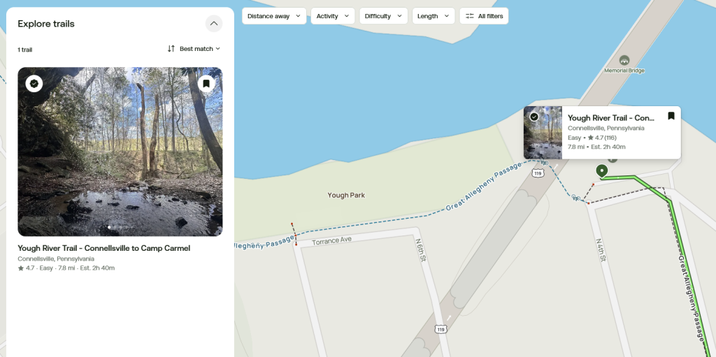
The Great Allegheny Passage starts in Cumberland, Maryland and runs approximately 150 miles through fantastic scenic hills and valleys, to Pittsburgh, Pennsylvania.
In this post, we’re going to explore the trail segment from Connellsville to Whitsett, PA.
History of the Trail
For a more detailed history of the Great Allegheny Passage, please see our overview.
History Along The Way
Connellsville
Nestled along the Youghiogheny River in northern Fayette County, Pennsylvania, the city of Connellsville boasts a rich history and a promising future.

The Youghiogheny River that runs through Connellsville, attracted native Americans including the Delaware tribes who settled in the area long before Europeans arrived in North America.
The word “Youghiogheny” (pronounced YOCK-uh-gay-nee, often shortened to “Yough” by locals) comes from the Lenape-Delaware Native American language, and is believed to mean “stream flowing in a contrary direction.”

The French were among the early Europeans to settle around the area in the 1700’s, attracted by the potential for great wealth in the fur trade. Then the English came, many from the Virginia colony, including the Stewart brothers who saw a chance to make some income by transporting settlers and other travelers by flatboat across the Youghiogheny River. The area was known as “Stewart’s Crossing” due to its popularity, and the location is still honored today on some modern maps.
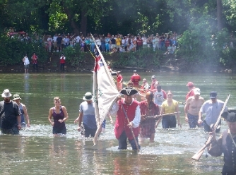
The French and Indian War that started in 1754, brought further notoriety to the area. In 1755, the British army under General Braddock, with his young aide-de-camp George Washington, bivouacked here and later crossed the Yough at this point on their way to the French Fort Duquesne, known today as Point State Park. Every year in June, Connellsville locals stage a reenactment of this event near the site of the crossing.
William Crawford, a land surveyor whom Washington had befriended and fought in the French and Indian War, made his way to Stewart’s Crossing, settling down in this area with his family after the war. Crawford surveyed thousands of acres around the Youghiogheny and Ohio Rivers for Washington. His cabin was reconstructed in the 1970’s and can be seen today on its site at what is now Yough River Park.

Zachariah Connell, a land surveyor and friend of both George Washington and William Crawford, settled in the area, and in 1793, he chartered some 45 acres of his holdings for a township in his name. Connellsville was officially incorporated as a borough in 1806. In 1909, the residents of the borough of New Haven on the south bank of the Youghiogheny River, and their neighbors in Connellsville on the north bank, voted to merge. The enlarged borough of Connellsville became Fayette County’s first city on May 12, 1911.
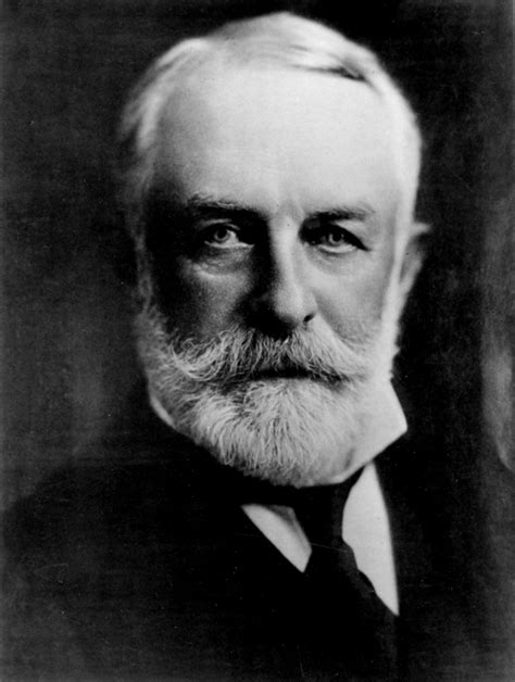
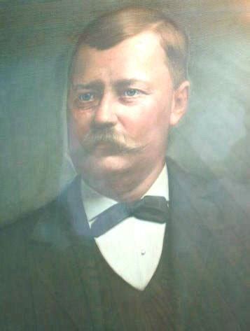
During the 1800’s coal was discovered in great abundance in the region, and Connellsville found itself right in the middle of what geologists called the Connellsville coalfield. A number of industrialists began exploiting this resource, and it’s said that Connellsville had more millionaires per capita than any other place in the country during the early coal mining years, including Henry Clay Frick, who started a coke plant in 1870 at Broad Ford near Connellsville, as well as Philip and Sarah Cochran, and W.J. Rainey.

Because of the highly-sought-after Connellsville coal, Connellsville thrived in the 19th and early 20th centuries as a center for coal mining and coke production, earning it the title “Coke Capital of the World,” due to its literally thousands of coke ovens and ancillary facilities that dotted the landscape along the river. At its height, the Connellsville Coke Region stretched for 50 miles and produced millions of tons annually, helping to power the steel mills of Pittsburgh and fueling the rise of American industry.
The arrival of the railroads also played a major role in Connellsville’s prosperity. The Pennsylvania, Baltimore & Ohio, Western Maryland, and Pittsburgh & Lake Erie lines were augmented by smaller railways that ran short lines to connect coal fields and coke production facilities to the main lines. The railroads proved to be much more efficient than the water route for delivering the coal and coke goods to the industrial center of Pittsburgh, which furthered Connellsville’s importance and prosperity.
In the mid-twentieth century however, coal mining was in a major decline in Fayette County, and with it, Connellsville’s population began to decline as workers sought employment elsewhere.
Today the Connellsville coke ovens have long since gone cold. But the city is embracing its new identity centered on recreation, history, and hospitality. The Great Allegheny Passage, which rolls right through the heart of Connellsville, has brought fresh energy, drawing cyclists and hikers from around the country.

As a major trail town along the Great Allegheny Passage, and participant in the Trail Town program, Connellsville has invested in trail-friendly amenities, including parks, lodging, and dining options, to enhance the experience of its guests.
The Yough River Trail Council which manages the Great Allegheny Passage from just outside Ohiopyle State Park through Layton, is a member of the umbrella organization Regional Trail Corporation, and works with the city to maintain the trail. It also sponsors various events and fundraisers throughout the year.
Connellsville’s rich history shines through in its modern-day efforts to provide a welcome to all who visit for work or play. Connellsville is a reminder that history doesn’t just live in the past, it rides with us, on every mile.
Trail Details
Trail Length
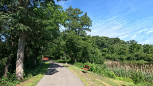
The point-to-point mileage for this segment has an approximate 2/10th mile differential. Yough River Park is considered the Connellsville trailhead, and the two main parking areas at Yough River Park are at either end of the park. So, the total distance from Connellsville to Whitsett is 15.1 miles point-to point measuring from the “eastern” or main parking area, and 14.9 miles when starting at the “western” or “Caboose” lot at the western end of Yough River Park.
Trail Surface
The treadway surface is primarily crushed limestone, with an average width of 8-10 feet.
The first small portion of the trail along the “eastern” lot shares the right-side berm of Front Street, and treadway of the trail is shared with the main walkway through Yough River Park which is paved. The spur trail from the western lot past the Connellsville Hiker-Biker Campground, and the remainder of the trail up to Whitsett is crushed limestone. There are a few paved portions at road crossings in Adelaide and Whitsett.
The first mile of the treadway where the eastern lot spur connects to the main trail, to the West Yough Bridge is about 10 feet wide. There is a small portion of the treadway entering Whitsett that’s about 6 feet wide.


In 2024, the Yough River Trail Council volunteers changed the barriers from outside Connellsville to Layton from central, right, and left-sided small boulders to steel gates that are mounted on either side of the treadway. When closed, they allow for a 2-foot space in the middle. The gates can also be locked open when needed for maintenance or during trail events, such as the annual 5K race that they sponsor as a council fundraiser, typically held every April.
Trail Signage
The Great Allegheny Passage utilizes standardized signage, as I mentioned more specifically in my overview of the trail [here].
Trail Views
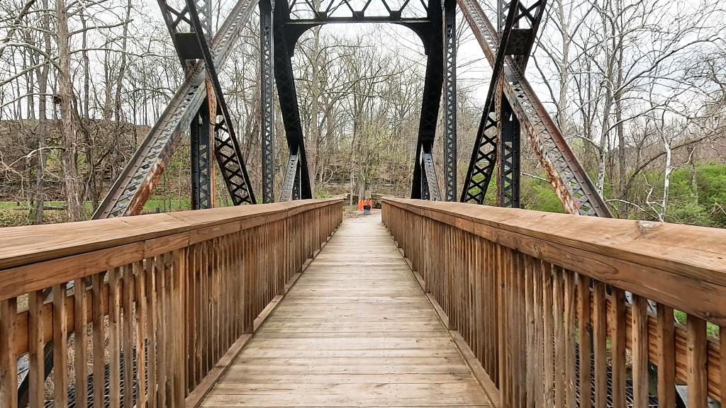
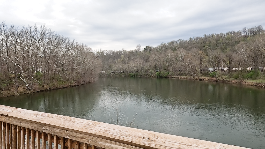
The Youghiogheny River is again our companion for the entirety of this segment. Mostly the river along this segment is rather calm; but it can get a bit more torrential after a series of heavy rains.
We’ll cross over 5 streams, all Youghiogheny tributaries, along this segment, but you’ll get really good views of three of them: Furnace Run, Virgin Run, and Slush Run.
We’re also treated to some industrial history along this segment; from coke ovens, to old bridges, and a bridge that historians are desperate to save.
Trailheads
Connellsville (GAP Mile 89)
Depending on where you look for trailhead information, you may find different answers. The Great Allegheny Passage Conservancy considers Yough River Park’s main lot along Front Street (right at GAP mile 89) to be the main parking area.
Google Maps marks the trailhead at the single-file parking along the park itself abutting Torrance Avenue.

AllTrails has the trailhead all over the place – from an arbitrary spot along South 1st Street, to the grassy area opposite the stage in Yough River Park (depending on the curated trail that you’re looking up).


So, to be as accurate as possible, let’s consider Yough River Park itself to be the actual trailhead area, with its two main parking areas on either end of the park as viable parking areas for trail users.
Trail Users: Don’t Park Here
I don’t consider the 26 single-file spaces along Torrance Avenue to be viable spots for trail staging, because the area is in my opinion, too cramped for this purpose. I’d recommend leaving the Torrance Avenue spaces to park visitors.
The “Eastern Lot” (GAP Mile 89.0)
At the eastern end of Yough River Park, is a large parking area that coincidentally sits exactly at the official GAP Mile 89 marker. It’s the main parking area serving Yough River Park.


This fully paved lot features 50 lined parking spaces aligned in two back-to-back rows, with 4 of them designated as handicapped. This lot is easily accessible by taking a left turn from West Crawford Avenue onto North 3rd Street.

All of the amenities – seating areas, benches, pavilions, restrooms, a bicycle repair station, and water fountains – are a very short walk (ride) away within the park itself just past the US Route 119 underpass.
Also within the park is the official GAP signage, the Connellsville trail welcome center, and Youghiogheny Coffee Company in the “concession stand.”

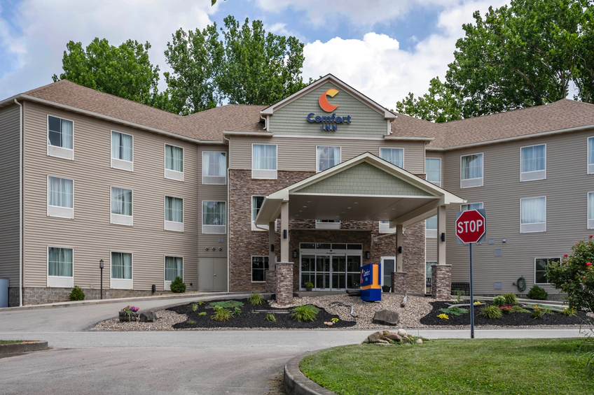
On the other side of this lot is the Comfort Inn and just past the hotel, is the Rivers Edge Cafe – a great spot for unwinding after an out-and-back.
The “Western Lot” (GAP Mile 89.25)
At the western end of the park, next to the Connellsville Hiker-Biker Campground, is the “western lot” or “Caboose lot”.


The western lot is situated behind Martin’s Supermarket in the Martin’s Plaza along US Route 119. At its entrance, you’ll see a wall with the name “Stewart’s Crossing” which is an homage to this area, as I mentioned in the town history (above).

This lot is a configured in a circle around a central island featuring some public art. The lot is fully paved, with 29 spaces including 2 designated as handicapped.
It’s sometimes listed as the “Caboose” lot because of the red 1956 bay window caboose built for the Baltimore & Ohio railroad, which was restored in 2012 and placed between the lot and the campground. Today it serves as a seasonal welcome center for Connellsville.


The lot is connected to the trail by means of a short paved spur that goes right past the Yough River Trail Council buildings and the campground. At the end of the spur are more GAP signage, and this lot’s other amenities: bike racks, a bike repair station, a water fountain, and restrooms.
Dawson (GAP Mile 94.6)
The Dawson trail access is a gravel lot across the Youghiogheny River from the town of Dawson. It’s accessible via Front Street and Hollow Road. The gravel, unlined lot holds about five to six vehicles. There are no amenities at this access.

A guard rail along the trail side of Hollow Road separates the road from the trail access staging area. There’s an opening at one end of the guard rail that allows easy access to the trail for people and bicycles. A municipal wastewater plant sits at the end of Hollow Road, at the far end of the parking area.
Layton (GAP Mile 102)
While Google Maps notes this spot as “Great Allegheny Passage parking”, the GAP Conservancy doesn’t mark this as an official parking access on either the website or in TrailGuide. Thus, it has no official GAP signage.
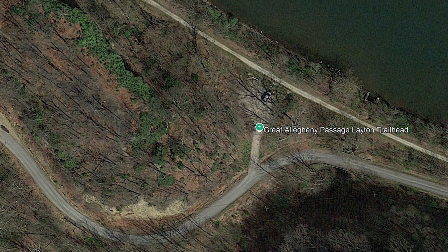
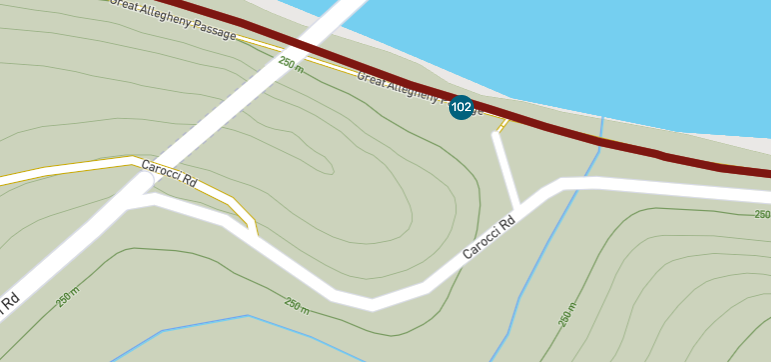

Notwithstanding, this small gravel lot holding 6-7 vehicles is definitely a place where the locals park. It’s accessible by turning off Layton Road outside of Perrypolis, onto Tunnel Road, which on some maps is renamed as Carocci Road. There are no amenities at this access.
Riding the Trail: Trail Tips
Savor the Trail Town Hospitality
I made a point in the accompanying video that Connellsville is the third major trailhead town in a row for the Great Allegheny Passage.
Connellsville is a very trail-friendly town, and features a number of nearby amenities for those either using Connellsville as a staging point for an out-and back, or for bike-packers passing through.
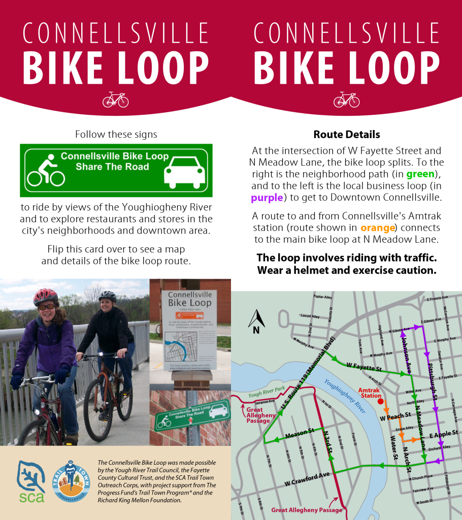
Connellsville has created the multi-tier “Connellsville Bike Loop” that allows cyclists to easily find some of those amenities. Some of these include Bikes Unlimited, the Amtrak station, and the local Sheetz convenience store.
Local eateries and coffee shops include Bali Brothers Kitchen, the Connellsville Canteen, Kickstand Kitchen, Coffee at Crawford, and River’s Edge Restaurant and Bar.
Within Yough River Park itself along the trail is the Youghiogheny Coffee Company. Martin’s Supermarket is right in front of the western parking area.
Penn Highlands Health System’s Highlands Hospital is close by on the north side of the Youghiogheny. While I hope you’ll never have to worry about visiting, it’s there just in case…!


I have it on good authority that all of these businesses are very friendly to trail users!
The Arch
The Connellsville Gateway Arch sits at the edge of the Connellsville Hiker-Biker Campground. Rising some 16 feet in the air, this colorful arch was designed by artist Steven Fiscus and installed by Jeff Dardozzy in 2008.
It’s made of a combination of formed concrete, coal, riveted steel, and colorful glasswork from Connellsville’s own Youghiogheny Opalescent Glass Factory.
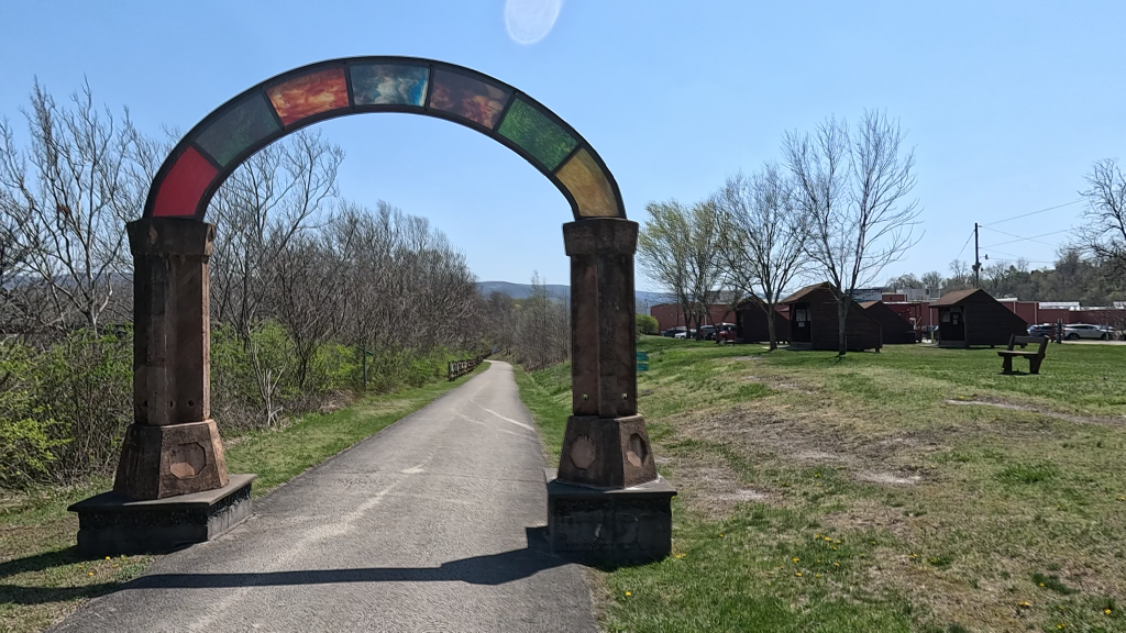
On a good day, you can look through the arch towards the park and see some glimpses of Connellsville, and definitely parts of the Chestnut Ridge range in the distance.
The Bridge You Can’t Cross
Sitting at approximately GAP Mile 91.5, you’ll find a small spur to the right that leads to the West Yough Bridge.
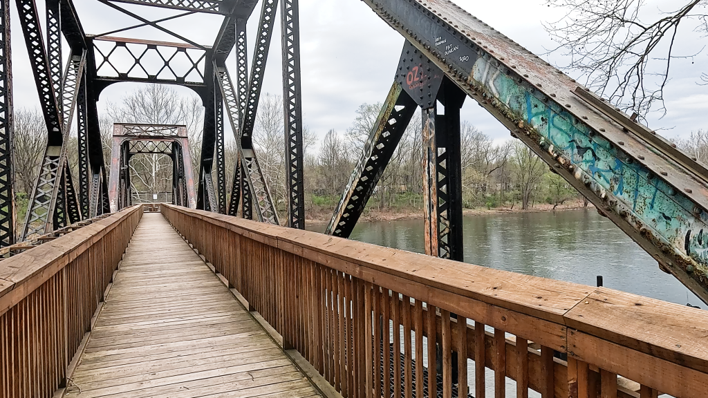
This is a former Pittsburgh & Lake Erie Railroad river crossing that was abandoned decades ago, and fell into disrepair.
The derelict structure was a magnet for vandalism and for adventure-seekers attempting to cross the bridge despite warnings of its weak structural integrity due to a fire reported on the railroad ties at the far end of the bridge that made attempts to traverse it dangerous.
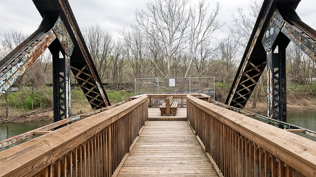
Because of its proximity to the Great Allegheny Passage, the GAP Conservancy worked with local groups including YRTC volunteers, to redeck most of the bridge on the trail-side.
So you can now safely walk across the span to a seating area that’s built about 2/3 of the way across, where a wire fence bars access to the weakest portion of the deck.
Notwithstanding that fact that you can’t go all the way across, the views of the Youghiogheny River at his point are striking.

Even though you “technically” can ride your bike across, the rebuilt decking is somewhat narrow, and it is difficult to turn a bike around. I’d recommend just parking at the trail spur and walking across.
The Old Whisky Bridge
Around GAP Mile 91.5, you may be able to see the remains of the old Overholt Distillery across the river. Just a bit further on, there’s a marker indicating the site of the “Swinging Bridge.”
This area is known as “Broadford Junction” (sometimes listed as Broad Ford due to the fact that it was a ford across the river along the old Native American Catawba Trail).
Even though the distillery is long since abandoned, and only urban explorers usually dare to enter the now-dilapidated buildings, you can learn more about the Overholt Distillery and the influence of the Overholt farm by visiting West Overton Museum in Scottdale (I highlighted this location in my previous video on the Coal and Coke Trail).

At the “Swinging Bridge” marker, there’s a footpath that you can follow to the river’s edge and you can spy the remnants of the bridge pilings and some of the steel connector wires. According to Bill Metzger in his book The Great Allegheny Passage Companion, this was a footbridge that allowed distillery managers who lived on the trail-side of the river to walk to the distillery.
The Blue Canoe
Within the village of Adelaide just after GAP Mile 92, is the Blue Canoe RV Resort. This is a nice place to rest for a bit if you need to, because the resort’s restaurant and store is open to GAP trail users as well as the resort guests.

For being in such a small village, this can be a pretty busy place. I’ve even seen the place nearly full-up in early spring!
Just be cautious riding past the resort. There’s one access road between the upper and lower portions of the resort that guests will use – frequently with golf carts – and even though the “stop sign” are not on the trail but on the resort’s accessway, I wouldn’t want to guarantee that all resort guests will actually stop for you when you ride past.
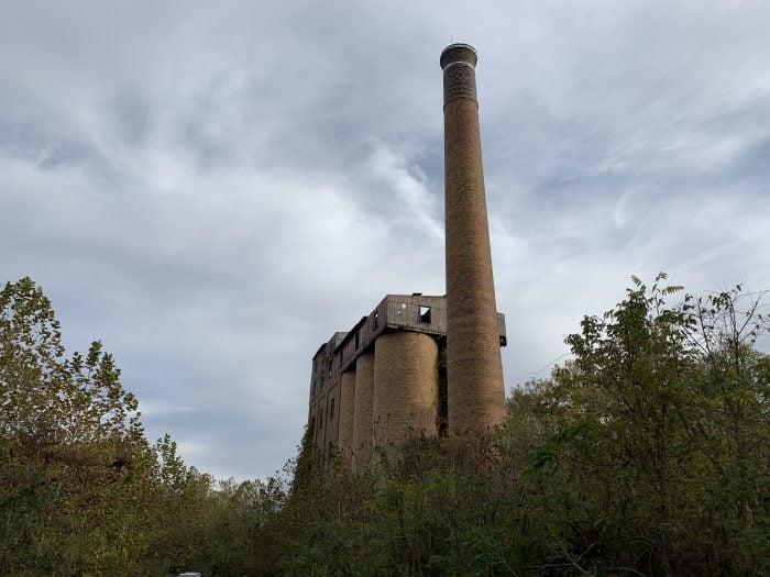
The Coke Ovens (No, not THAT kind of Coke)

Around GAP Mile 93, you’ll find some of the old Connellsville Coke Ovens. Around this area are also a wood-board explaining the history that was a young man’s Eagle Scout project, and a GAP-placed marker denoting the site.
These represent some of the nearly 38,000 structures that once covered the regional landscape around the turn of last century. Local miners unearthed a large, long-lasting seam of high-quality coal, which was perfect for baking in these beehive-shaped, stone or brick ovens.
If you’re not sure what part coke played in the making of steel, here’s a brief explanation. At high temperatures, high-quality coal turns into coke, which was used as an industrial fuel in blast furnaces to smelt iron ore into molten pig iron – the raw material for steel.
There’s a Blogspot site “Old Industry of Southwestern Pennsylvania“, run by “Coke Oven Mike” that has additional historical information and lots of pictures!

These coke oven remnants along the trail are on private property, so I don’t recommend trespassing and walking up to them. During the spring and summer, they’re a bit harder to see. But during fall, winter, and early spring before the foliage returns, they’re very easy to see from the trail.
Ol’ Rainey “town”
In this same area, behind what we can see of the coke ovens, is what remains of the old “Fort Hill Coke Works” run by W.J. Rainey. At its height, Rainey’s works was the second largest coke producer in the Connellsville district.
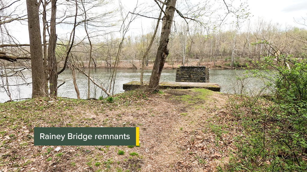
The Rainey works across the river at this point was connected by a bridge built in 1882. But time and tide have destroyed most of the bridge pilings, though you can see what remains of them thanks to a foot path down to them from the trail.
The Old Roundhouse
Just after passing the Dawson trail access, you’ll the remains of the Dickerson Run rail yard and roundhouse.

This was a sprawling rail yard that served as an interchange for the P&LE, the Western Maryland Railroad, and the Pittsburgh & West Virginia Railroad and was an important coal marshaling facility.
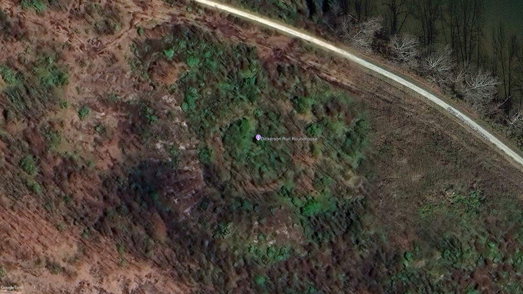

You can see the remains of the roundhouse on Google Maps, and in the accompanying video, I highlighted some drone footage of the remains of the inner portion of the roundhouse.
See Them Run(s)
I mentioned earlier that on this segment, we roll by multiple streams. Between GAP Miles 96 and 99, we cross wood bridges over Furnace Run and Virgin Run. There are covered seating areas adjacent to the bridges, so you can take a few minutes and enjoy these peaceful waters.


Next to the Round Bottom Hiker-Biker Campground is Slush Run, that certainly can give the campers some peaceful scenery!
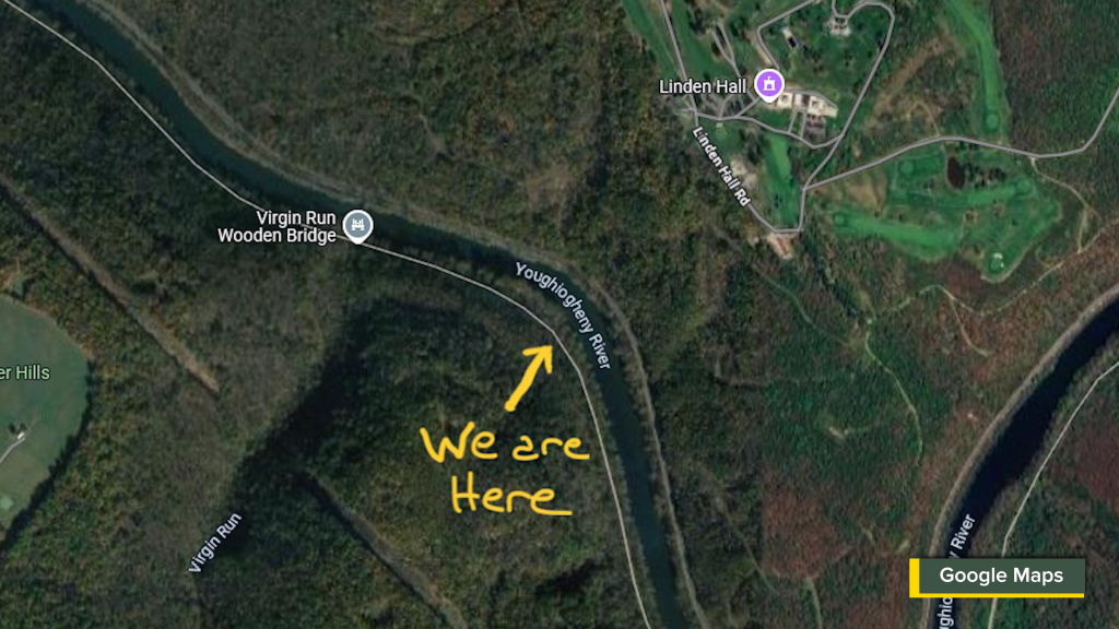
Linden Hall
Even though you can’t see it at all from the trail, when you reach GAP Mile 98, you’re about parallel to Linden Hall that’s just beyond the hill on the other side of the river. If you remember in the history of Connellsville when I mentioned Sarah Cochran, she surfaces again as the force behind the creation of Linden Hall.
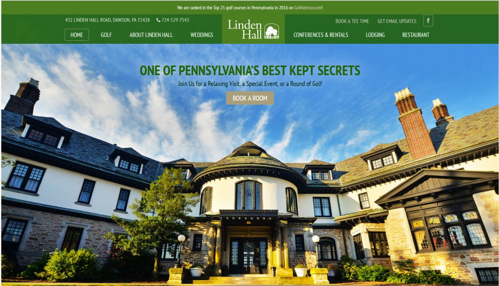
Since her death, the mansion and the grounds have passed hands here and there, and ended up being owned by United Steelworkers, who operate it as a seasonal resort and training center.
The Round Bottom
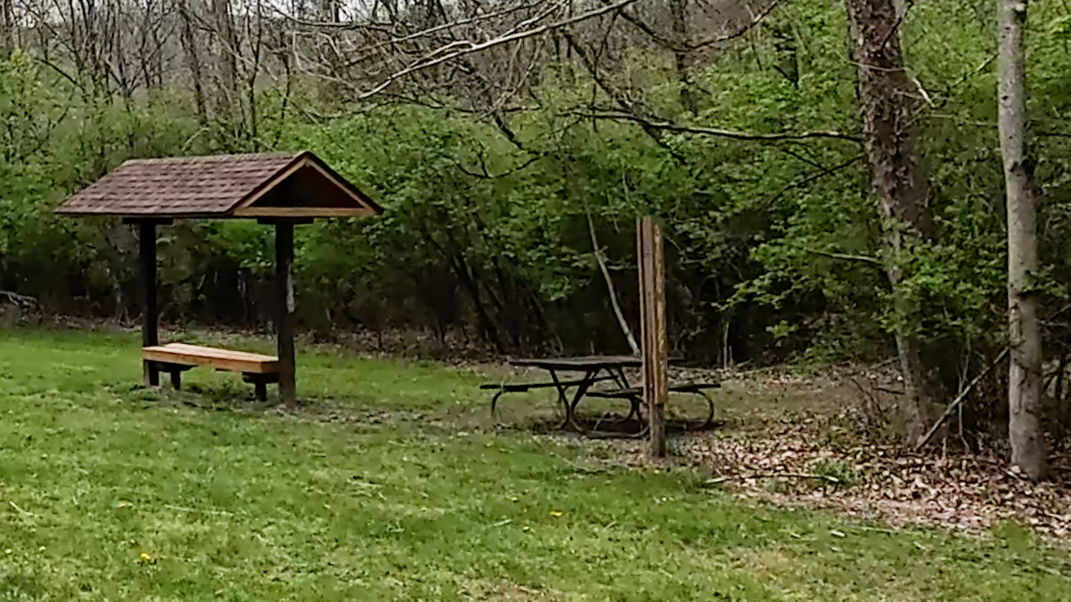
At GAP Mile 99.6, Approximately 10 and a half miles from the start of this segment, the Round Bottom Hiker-Biker Campground is nestled along a bend in the Youghiogheny River.
It’s a spacious campground area, with room for over 100 tents. It also features three Adirondack-type shelters – two for parties of six people, and one solo unit, two fire rings (with free firewood available), a pair of grills, and two picnic tables.

There is a composting toilet on the opposite side of the trail, and a well with non-potable water. River access offers secluded spots for fishing and birdwatching. Lovely Slush Run tumbles off the hillside and winds through the campground. Use of the campground is free, does not require reservations, but is on a first-come, first-served basis.
Kier Fire Bricks
Just after GAP mile 101, there are some abandoned buildings you’ll see on the left. Again, Bill Metzter has come to the rescue. In his book The Great Allegheny Passage Companion, he explains that this area was sometimes known as Kier.


These buildings are what’s left of the old Kier Fire Brick Company. Apparently this particular area was well known “fire clay”, which was suitable for making furnace bricks. According to Metzger, workers dug the fire clay in Kilndigging Hill that’s right behind this now long-abandoned plant.
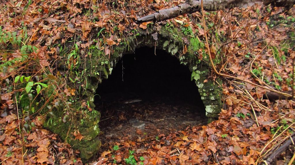
The Narrow Bridge (GAP Mile 102)
Just past the parking area at Layton near Perryopolis, the Layton Bridge crosses the Youghiogheny River, over the trail, and connects to the Layton Tunnel which runs through the hillside to the left of the trail as you ride under the bridge.

A Pratt truss style bridge, the Layton Bridge and its adjacent single-lane tunnel on the western side of the river, was built in 1899 for the Washington Run Railroad, but was abandoned in 1931. The bridge and tunnel were later converted for single-lane automobile use in order to connect the village of Layton with Perryopolis.
The PA Department of Transportation (PennDOT) had plans to close the bridge in mid-June 2024 for extensive work; but per the PennDOT website, there don’t appear to be any restrictions to the trail due to the closure of the bridge.
Trail Impression
The Connellsville to Whitsett segment of the Great Allegheny Passage is an excellent 15-mile point-to-point ride with a variety of interesting historical features, lots of wonderful peaceful forested vistas, as well as long, lingering looks at the Youghiogheny River along the way. It’s another longer segment of the GAP, but well worth the ride!